EasyManuals Logo

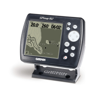
Garmin GPSMAP 182 User Manual

Garmin GPSMAP 182
104 pages
To Next Page IconTo Next Page
To Previous Page IconTo Previous Page
Page #91 background imageLoading...
Page #91 background image
81
Appendix F
Navigation Terms
Avg Speed— The average of all second-by-second speed readings since last reset.
Bearing (BRG)— The compass direction from your present position to a destination waypoint.
Course— The desired course between the active ‘from’ and ‘to’ waypoints.
Distance (Dist)— The ‘great circle’ distance from present position to a destination waypoint.
Distance to Destination— The ‘great circle’ distance from present position to a GOTO destination,
or the fi nal waypoint in a route.
Distance to Next— The ‘great circle’ distance from present position to a GOTO destination, or the
next waypoint in a route.
Elevation— Height above mean sea level (MSL).
ETA— Estimate Time of Arrival. The estimated time you will reach your destination waypoint, based
on current speed and track.
ETA at Destination— The estimated time you will reach a GOTO destination, or the fi nal waypoint
in a route.
ETA at Next— The estimated time you will reach a GOTO destination, or the next waypoint in
a route.
Fuel— The fuel required to travel from present position to the indicated route waypoint.
Leg Dist— The distance between two route waypoints.
Leg Fuel— The fuel required to travel from a route waypoint to the next waypoint (in sequence)
in the route.
Leg Time— The time required to travel from a route waypoint to the next waypoint (in sequence)
in the route.
Max Speed— The maximum second-by-second speed recorded since last reset.
Moving Average Speed— Average speed while the unit is moving.
Moving Trip Timer— Total time the unit has been moving.
182C Manual Part 2.indd 81 6/4/2003, 2:54:29 PM

Other manuals for Garmin GPSMAP 182

Questions and Answers:

Question and Answer IconNeed help?

Do you have a question about the Garmin GPSMAP 182 and is the answer not in the manual?

Garmin GPSMAP 182 Specifications

GPSMAP 182/182C

Display IconDisplay
display size5.5" diagonal (14.0 cm)
display typehigh-resolution, 10-level grayscale LCD with backlighting
display resolution240 x 360 pixels
Power IconPower
power source8-35v DC
power usage4 watts max. at 13.8v DC
Operating Environment IconOperating Environment
temperature range5ºF to 158ºF (-15ºC to 70ºC)
caseFully gasketed, high impact plastic alloy, waterproof to IEC 529 IPX7 standards
antennaGA 29 remote marine mount with 30' cable or bail mount antenna
GPS Performance IconGPS Performance
receiverWAAS enabled, 12 parallel channel GPS receiver
acquisition time (warm)Approximately 15 seconds
acquisition time (cold)Approximately 45 seconds
Weight and Dimensions IconWeight and Dimensions
width6.3"
height6.2"
depth2.6"
weight1.7 lbs. (.77 kg)

GPSMAP 232

Display IconDisplay
display size7.1" diagonal (18.0 cm)
display typehigh-resolution, 10-level grayscale LCD with backlighting
display resolution240 x 360 pixels
Power IconPower
power source8-35v DC
power usage4 watts max. at 13.8v DC
Operating Environment IconOperating Environment
temperature range5ºF to 158ºF (-15ºC to 70ºC)
caseFully gasketed, high impact plastic alloy, waterproof to IEC 529 IPX7 standards
antennaGA 29 remote marine mount with 30' cable
GPS Performance IconGPS Performance
receiverWAAS enabled, 12 parallel channel GPS receiver
acquisition time (warm)Approximately 15 seconds
acquisition time (cold)Approximately 45 seconds
Weight and Dimensions IconWeight and Dimensions
width7.7"
height7.5"
depth2.6"
weight2 lbs. (.91 kg)

Related product manuals