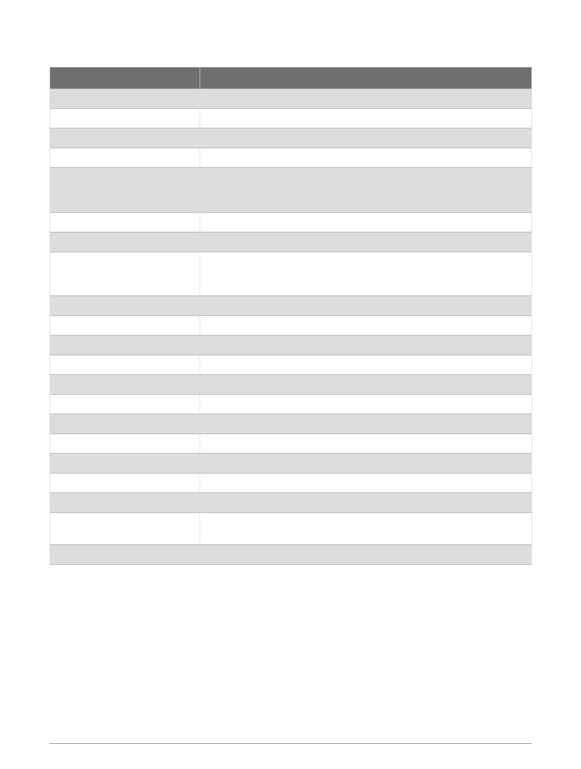
GPSMAP 8x17 Specifications
Specification Measurement
Dimensions (W × H × D) 41.9 × 30.7 × 7.1cm (16.5 × 12.1 × 2.8in.)
Display size (W × H) 36.6 × 23.1cm (14.4 × 9.1in.)
Display resolution WUXGA, 1920 × 1200 pixels
Weight 5.2kg (11.48lb.)
Compass-safe distance
Device: 53.34cm (21in.)
Device and sun cover: 99.06cm (39in.)
Sun cover: 48.26cm (19in.)
Temperature range From -15° to 55°C (from 5° to 131°F)
Material Polycarbonate plastic and die-cast aluminum
Water rating
IEC 60529 IPX7
The device withstands incidental exposure to water of up to 1m for up to
30min. For more information, go to www.garmin.com/waterrating.
Fuse 15A
Input voltage From 10 to 35Vdc
Max. power usage 40W
Typical current draw at 12Vdc 2.8A
Typical current draw at 24Vdc 1.4A
Max. current draw 3.5A
NMEA 2000 LEN @ 9Vdc 2
NMEA 2000 Draw 75mA max.
Max. waypoints 5,000
Max. routes 100
Max. active track points 50,000 points, 50 saved tracks
Wireless frequency and protocols
Wi‑Fi, ANT, and Bluetooth technologies
2.4GHz @ 17.21dBm max.
HTML integration Compatible with OneHelm integration
Appendix 195