EasyManuals Logo

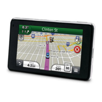
Garmin nuvi 3490 User Manual

Garmin nuvi 3490
76 pages
To Next Page IconTo Next Page
To Previous Page IconTo Previous Page
Page #31 background imageLoading...
Page #31 background image
nüvi 3400 Series Owner’s Manual 25
3
Select a detour option:
Next �5mi on Route.
Next 2mi on Route.
Next 5mi on Route.
Detour by Road(s) on Route.
4
If necessary, select a road to detour around.
Navigating Off Road
If you are not following roadways as you
navigate, you can use Off Road mode.
1
Select Settings > Navigation.
2
Select Calculation Mode > Off Road >
Save.
The route will be calculated as a straight line
to the location.
Map Pages
Customizing the Map
Customizing the Map Layers
You can customize which data appear on the
map, such as icons for points of interest and
road conditions.
1
From the map, select .
2
Select Map Layers.
3
Select which layers you want to include on
the map, and select Save.
Viewing the Trip Log
Your device keeps a trip log, which is a record of
the path you have traveled.
1
Select Settings > Map and Vehicle > Map
Layers.
2
Select the Trip Log check box.

Table of Contents

Other manuals for Garmin nuvi 3490

Questions and Answers:

Garmin nuvi 3490 Specifications

General IconGeneral
Display Size4.3 inches
Display Resolution480 x 272 pixels
BatteryRechargeable lithium-ion
Battery LifeUp to 4 hours
High-Sensitivity ReceiverYes
Preloaded MapsYes
Custom POIsYes
Lane AssistYes
Junction ViewYes
BluetoothYes
ecoRouteYes
Voice-activated navigationYes
Traffic updatesYes
Multi-destination routingYes
Speed limit indicatorYes
3D buildings and landmarksYes
Photo navigationYes
Custom vehicle iconsYes
Where Am I? featureYes
Garmin Real DirectionsYes
Garmin ConnectYes
Voice CommandsYes
Display TypeWQVGA

Related product manuals