060-4314-000 • Rev. C - May 2004
32 MK VI & MK VIII EGPWS Pilot Guide
Non-Peaks
display
continued
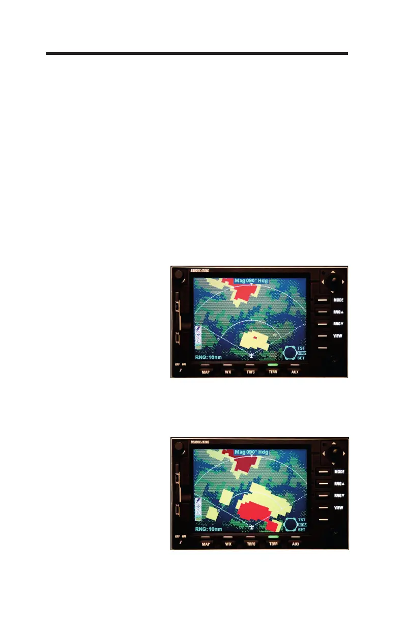
60 Seconds from
projected impact
“Caution Terrain!”
Each specific color and intensity represents terrain (and ob-
stacles) below, at, or above the aircraft's altitude based on the
aircraft's position with respect to the terrain in the database. If
no terrain data is available in the terrain database, then this area
is displayed in a low-density magenta color. Terrain more than
2000 feet below the aircraft, or within 400 (vertical) feet of the
nearest runway elevation, is not displayed (black). With version
-022 or later, the transition to black may occur below 400 feet
based on runway and terrain database integrity for a given area.
NOTE: All terrain databases after 419 contain 100% of
earth's terrain data, hence no magenta will be displayed ex
-
cept in Self-Test or on the edge of the regional database.
When a caution alert is triggered, the terrain (or obstacle) that
created the alert is changed to solid yellow as illustrated below.
30 Seconds from
projected impact
“Terrain, Terrain,
–Pull Up!”
When a warning alert is triggered, the terrain (or obstacle) that
created the alert is changed to solid red as illustrated below.
 Loading...