060-4314-000 • Rev. C - May 2004
MK VI & MK VIII EGPWS Pilot Guide
31
Non-Peaks
display
(see page 37) and the altitude input to the look-ahead algorithm.
Because it is primarily comprised of GPS altitude, this reference
altitude will often differ from cockpit displayed corrected baro
-
metric altitude. This altitude is not to be used for navigation. It
is presented to provide the crew with additional situational aware-
ness of true height above sea level, upon which terrain alerting
and display is based.
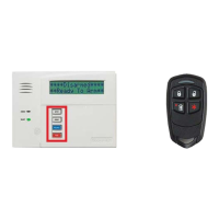
TERRAIN IS SHOWN
IN SHADES OF GREEN,
YELLOW AND RED
NOTE: With respect to Non-Peaks or Peaks display, terrain
and or obstacle presentation is always based on (and scaled
for) the geographic area (display range) available for display.
Consequently, terrain and/or obstacles outside of the selected
display range and defined display sweep are not included on
the displayed image.
The Non-Peaks display provides a graphical plan-view image of
the surrounding terrain as varying density patterns of green, yel
-
low, and red as illustrated in the following graphics. The selected
display range is also indicated on the display, and an indication
that TAD is active is either indicated on the display (i.e., "TERR" )
or by an adjacent indicator.
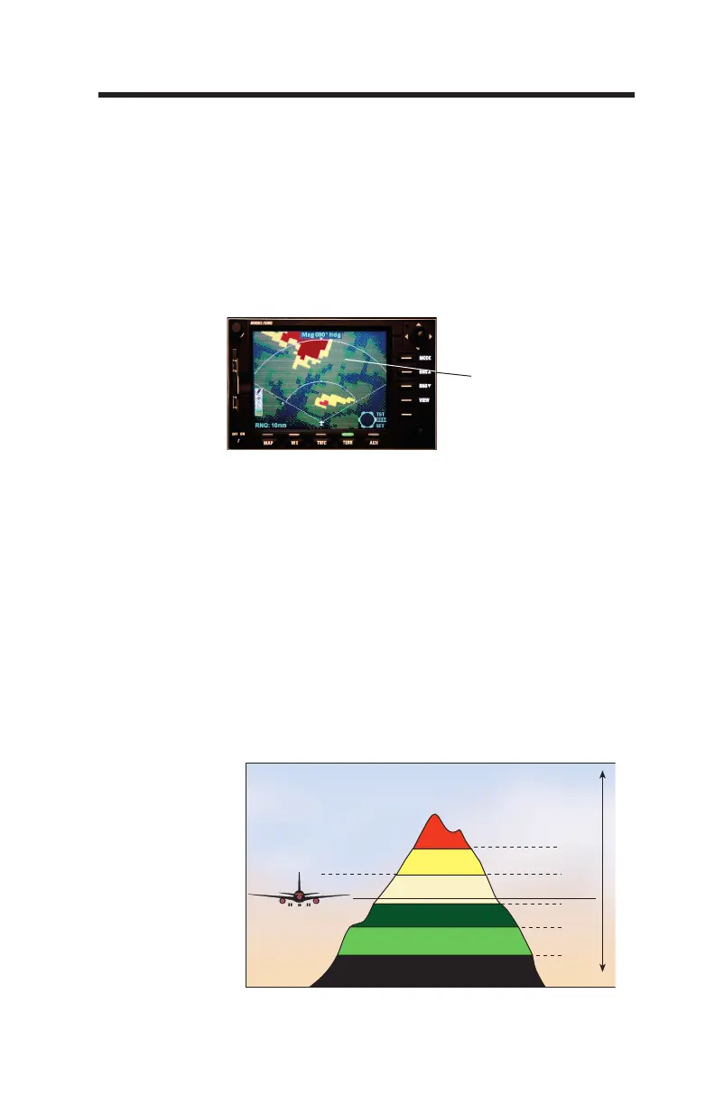
+2000'
+1000'
-1000'
-2000'
0
(Variable)
Aircraft Elevation
-500’
High Density Red
High Density Yellow
Low Density Yellow
Black
High Density Green
Low Density Green
 Loading...