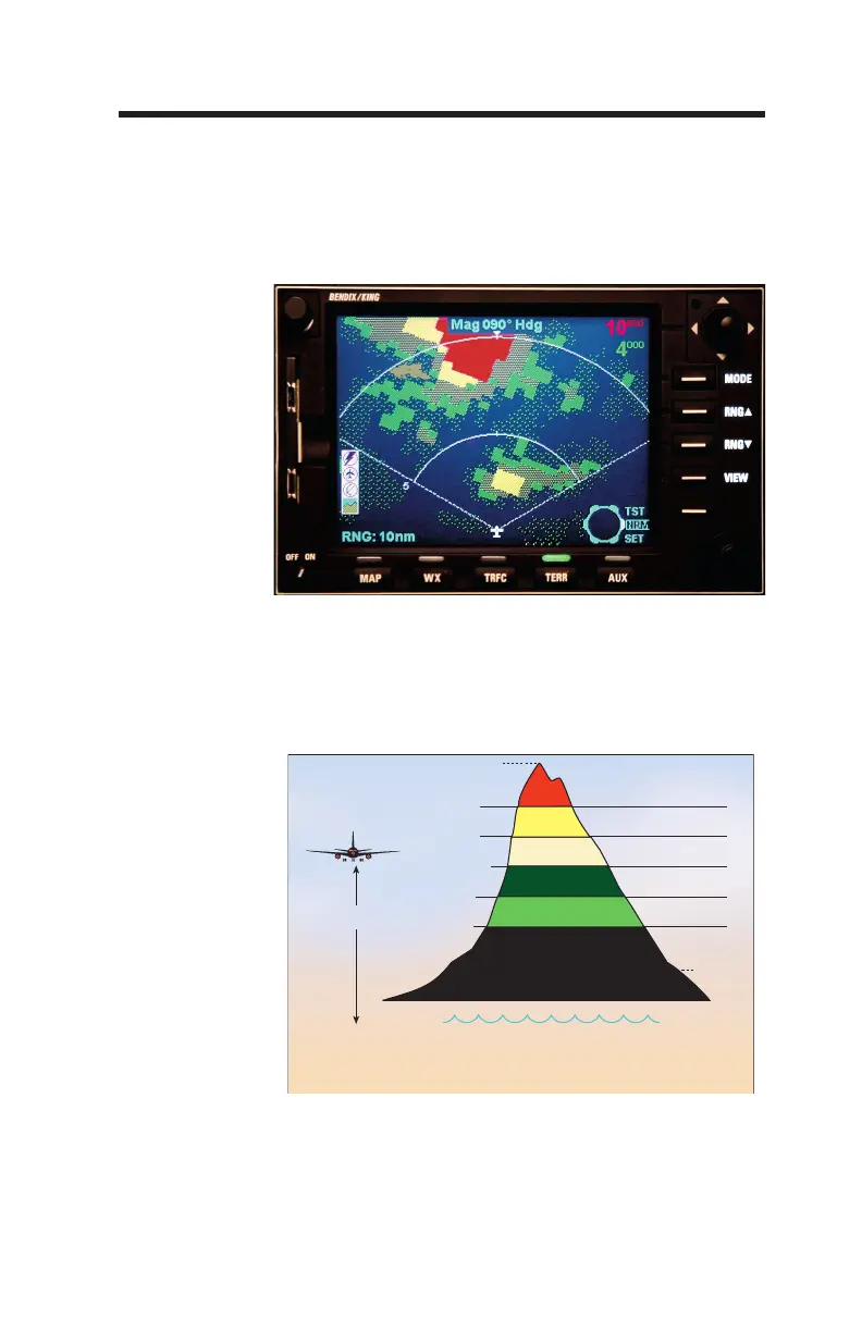
tude.
Ref Altitude + 2000
Ref Altitude + 1000
Ref Altitude -250/-500
(Maximum Elevation Number)
Reference
Altitude
Black
CyanSea Level
Ref Altitude -1000
Ref Altitude -2000
(Minimum Elevation Number)
Reference Altitude is projected down from actual aircraft altitude to provide a 30 second advance
display of terrain when descending more than 1000 FPM.
Te
rrain is not shown if it is below the lowest band and/or is within 400 feet (or lower if version -022
or later is installed) of the runway elevation nearest the aircraft. Sea level water is displayed if
supported by the display.
High Density Red
High Density Yellow
High Density Green
Low Density Yellow
Low Density Green
 Loading...