87
animated arrow with a pop-up name box (the name box disappears af-
ter a few seconds). Examples are displayed in the following figures.
To view Tidal Current information:
1. Use the arrow keys to move the cursor over a Tidal Current Station
icon. When it is selected, a pop-up name box appears.
2. Press
WPT to display the Tidal Current Information screen.
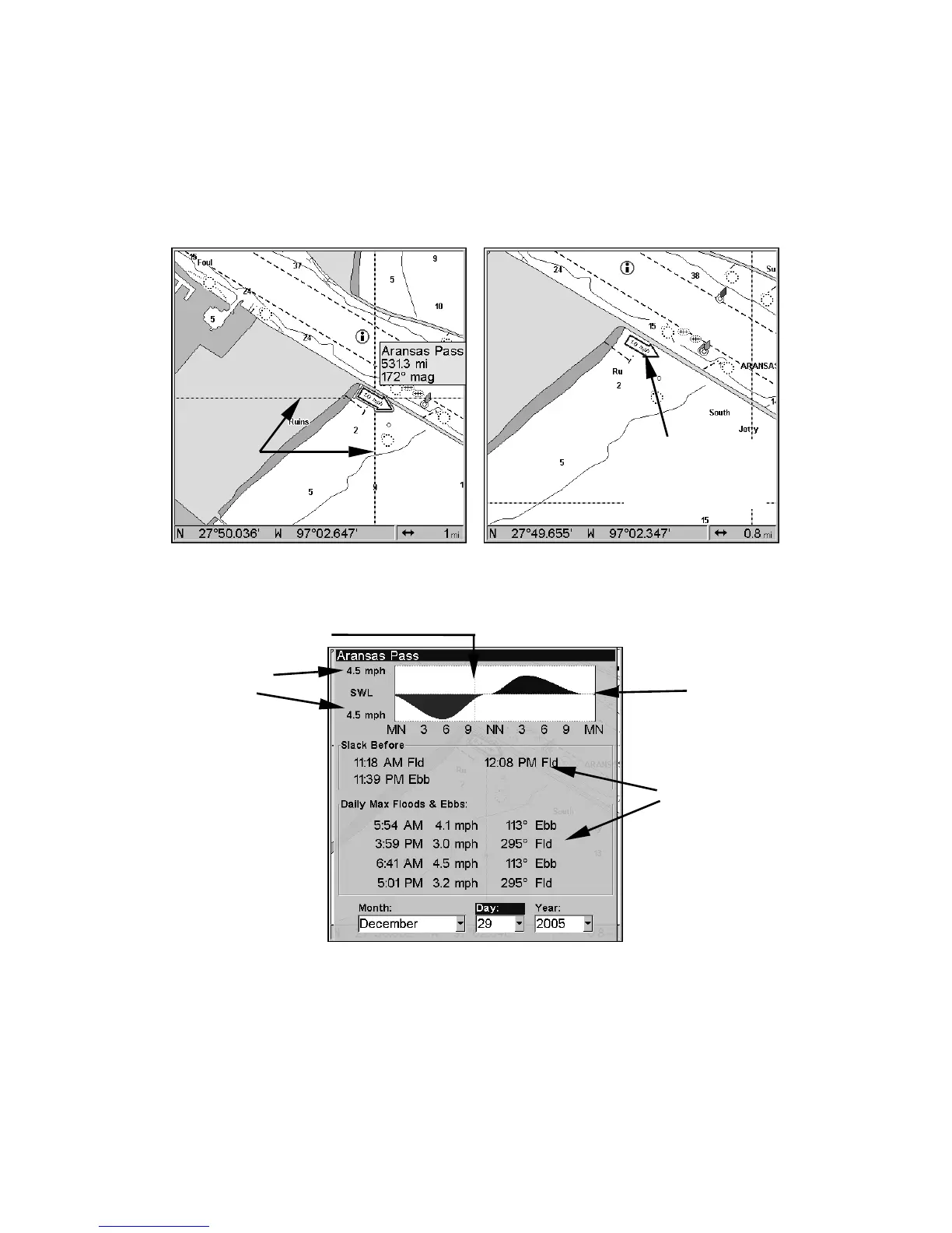
NauticPath chart showing Tidal Current Station icon selected by cur-
sor (left). Tidal Current animated icon at .8-nautical mile range.
Current Information screen.
The Tidal Current Information screen displays daily tidal current data
for this station on this date at the present time. The graph at the top of
the screen is an approximate view of the flood and ebb pattern for the
day, from midnight (MN), to noon (NN) to midnight (MN). The velocity
scale at the top left side of the graph changes dynamically based upon
the maximum velocity of the current for that day.
Cursor
lines
Tidal Current
Station icon in
animated mode
Slack
Water

 Loading...