Do you have a question about the Lowrance LMS-320 and is the answer not in the manual?
| Brand | Lowrance |
|---|---|
| Model | LMS-320 |
| Category | Fish Finder |
| Language | English |
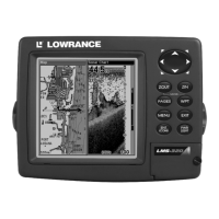
Details the general, sonar, and GPS capabilities and specifications of the LMS-320 and LMS-320DF units.
Explains the fundamental principles and components of the sonar system used in the LMS-320.
Describes the basic operation of the LMS-320's GPS receiver, satellite signals, and mapping functions.
Provides an overview of the Global Positioning System (GPS) and the Wide Area Augmentation System (WAAS).
Explains text formatting, key usage, and menu command conventions for navigating the manual.
Outlines the recommended sequence and initial steps for installing the sonar and GPS systems.
Provides detailed instructions for mounting the Skimmer transducer on a transom, trolling motor, or hull.
Lists the necessary tools and supplies for various transducer installation types.
Offers guidance on choosing the optimal location for transducer mounting to ensure proper water flow.
Details the assembly of the transducer bracket and its mounting on the boat's transom.
Explains how to attach the optional TMB-S bracket to the transducer for trolling motor mounting.
Discusses how transducer angle affects the appearance of fish arches on the sonar display.
Covers the necessary preparation steps for installing a transducer through a fiberglass hull.
Provides instructions for epoxying the transducer to the hull for shoot-thru-hull installation.
Illustrates the wiring and connection for various speed and temperature sensors.
Details the process for installing an optional speed sensor onto the boat's transom.
Explains the installation and placement of the GPS antenna/receiver module for optimal sky view.
Guides on how to properly connect the unit to a 12-volt battery system, emphasizing noise isolation.
Describes how to connect the unit for NMEA and DGPS data exchange with other devices.
Covers the options for mounting the LMS-320 unit using its gimbal bracket, in-dash, or portable setups.
Details how to install the unit using the supplied gimbal bracket, including cable routing.
Explains how to mount the unit in a boat's dash using an optional adapter kit.
Describes how to use the unit in a portable configuration with an optional power pack and accessories.
Guides on how to insert and remove MultiMedia Cards (MMC) or Secure Digital Cards (SDC).
Lists additional accessories available for the LMS-320, such as card readers and switch boxes.
Identifies and explains the function of each key on the LMS-320 unit's keypad.
Details how to turn the unit on and off, and control the backlight settings.
Describes the Main Menu structure and the function of its commands.
Explains how to navigate between the four main page displays: Status, Navigation, Map, and Sonar.
Provides detailed information on the unit's satellite lock-on status and position acquisition.
Displays compass rose, track, and bearing information for navigation, including waypoint direction.
Shows a bird's-eye view of the map with current position, track, and course line data.
Displays the sonar chart, showing echoes representing fish, structure, and the bottom.
A simplified 10-step guide for basic fish finding operations using factory default settings.
Explains basic sonar operations, focusing on the Sensitivity setting for adjusting echo detection.
Compares using Fish I.D. symbols versus interpreting fish arches for identifying fish.
Information on accessing online tutorials, Sonar Viewer software, and PC emulator for training.
Details the ASP feature for noise rejection and its four adjustable levels: Off, Low, Medium, and High.
Describes the three types of sonar alarms: Fish Alarm, Zone Alarm, and Depth Alarm (Shallow/Deep).
Explains how to set and use shallow and deep depth alarms to alert users to specific depth ranges.
Details the Zone Alarm feature, which triggers when echoes appear within a defined depth range.
Explains how to enable the Fish Alarm, which sounds when the Fish I.D. feature detects fish.
Guides on calibrating the speed sensor by comparing its readings to GPS ground speed.
Explains chart speed settings and how adjusting it can affect image clarity and fish arch appearance.
Describes how to use the depth cursor to pinpoint the depth of targets on the sonar display.
Explains the Auto Ranging feature, which automatically sets the sonar display's depth range.
Details how to manually control the sonar display's depth range for precise viewing.
Explains how to set custom upper and lower depth limits to zoom into specific water columns.
Describes the FasTrack feature, which converts echoes into short horizontal lines for rapid updates.
Explains the Fish I.D. feature, which identifies and displays fish as symbols on the screen.
Details the FishTrack feature, which shows the depth of fish symbols when Fish I.D. is active.
Describes FishReveal mode, which uses gray tones to enhance visibility of fish targets in clutter.
Explains how to change the transducer frequency between 200 kHz and 50 kHz for different water conditions.
Details the Grayline feature, used to distinguish between strong and weak echoes for bottom detail.
Explains the HyperScroll feature, which provides faster screen updates by increasing ping speed.
Guides on saving sonar data logs to an MMC card for playback on the unit or computer.
Refers to the ASP feature entry for information on reducing noise and interference on the sonar display.
Explains how to customize the digital data displayed on the Sonar or Map pages, including font size.
Details Ping Speed control, its relation to HyperScroll, and optimizing sensitivity for high ping rates.
Guides on resetting all unit features, options, and settings to their original factory defaults.
Explains how to reset the Water Distance ('W Distance') measurement to zero.
Guides on calibrating depth readings to account for the transducer's position relative to the keel.
Explains how to adjust unit sensitivity for optimal echo detection in varying water conditions.
Describes how to change the sonar chart display color scheme from grayscale to other options.
Lists and explains the available sonar chart display options accessible via the Pages Menu.
Describes the default sonar display mode showing the entire water column from surface to bottom.
Explains the split chart view, showing an enlarged section of the sonar display alongside the main view.
Details the split screen view for dual-frequency units, showing 50 kHz and 200 kHz data simultaneously.
Describes the mode displaying digital data in windows alongside the sonar chart on the screen.
Explains the Flasher page, which provides a circular dial view of sonar returns at a high refresh rate.
Details the screen option that splits the display into map on the left and sonar on the right.
Guides on using the built-in simulator to practice sonar and GPS operations without being on the water.
Explains how to turn off the sonar display and stop the chart from scrolling temporarily.
Describes the Surface Clarity control, used to reduce or eliminate surface clutter signals from the display.
Explains how to set upper and lower depth limits to zoom into specific water columns for better target detail.
Details how to use the ZIN and ZOUT keys to enlarge specific areas of the sonar display.
Explains the Zoom Pan feature, allowing users to move zoomed areas up and down the water column.
Identifies and explains the function of each key on the LMS-320 unit's keypad for GPS operations.
Details how to turn the unit on and off and control the backlight for GPS functions.
Describes the Main Menu structure and its commands relevant to GPS operations.
Explains navigation between the four main page displays: Status, Navigation, Map, and Sonar.
Refers to Section 3 for details on the Sonar Page display and its functions.
Provides detailed information on GPS satellite lock-on, position acquisition, and signal quality.
Displays compass rose, track, and bearing information for navigating to waypoints or routes.
Shows a bird's-eye view of the map with current position, track, and course line during GPS navigation.
Explains how the unit automatically finds the current position using satellites under clear sky conditions.
Details how to use zoom keys and arrow keys to navigate and explore the map display.
Guides on using the cursor to select map items like POIs or features for more information.
Introduces the search functionality for finding locations like restaurants or addresses using map data.
Explains how to create and save waypoints at current position, on map, or by entering coordinates.
Guides on selecting and navigating to saved waypoints using Find Waypoint commands.
Explains how to measure the distance and bearing from the current position to a selected map location.
Details how to measure the distance between any two points selected on the map display.
Describes how to create, delete, and navigate to icons used for marking locations on the map.
Guides on using the cursor to select an icon and navigating to its location.
Explains routes as sequences of waypoints used for navigation courses and travel paths.
Details how to create and save routes directly on the unit or using MapCreate software.
Guides on following a saved route, showing navigation information on Map and Navigation pages.
Explains how to follow a saved route in reverse order, from the end waypoint to the beginning.
Describes trails as records of paths taken, useful for retracing trips or marking routes.
Provides instructions for erasing specific trails or all trails from memory.
Guides on renaming saved trails using the Edit Trail menu.
Explains how to change the color style of a trail display.
Details how to change the line pattern (e.g., dotted, solid) used to display trails.
Covers options for changing trail visibility, activity, and maximum points recorded.
Explains how to set units for speed, distance, depth, temperature, and heading.
Details how to enable, disable, and adjust distance settings for GPS alarms like Arrival, Off Course, and Anchor.
Explains how the GPS receiver automatically searches for satellites to determine its position.
Guides on accessing the MMC File Browser to view files and check available storage space.
Explains how to configure the NMEA 0183 communication port for data transfer with other devices.
Details how to configure the unit to recognize and use DGPS receivers like Starlink or Magnavox.
Explains how to configure specific NMEA sentences for use with the unit's communication port.
Guides on selecting the coordinate system for displaying and entering position data (e.g., Degrees, UTM).
Explains how to configure Map Fix to find position on a printed chart using a reference latitude/longitude.
Explains how to customize display options for Position, Navigation, and Map pages.
Describes the DGPS Status screen for checking DGPS signal quality and diagnosing issues.
Guides on using the GPS simulator for practicing navigation without an active GPS signal.
Explains how to hide GPS menus and features when no GPS antenna is attached.
Describes how to initialize the GPS unit to a selected location for simulator or practice mode.
Details the auto zoom feature that adjusts map scale during navigation for better destination visibility.
Explains options for managing map display, including turning maps on/off, pop-up info, and overlays.
Guides on enabling or disabling the display of map data elements on the screen.
Explains how to turn the pop-up map information boxes on or off.
Guides on turning map boundaries or high-detail areas on or off.
Explains how to fill land areas on the map display with a gray color.
Details how to set map overlays like range rings and latitude/longitude grids for distance estimation.
Explains how to select map datums, which affect the accuracy of latitude/longitude positions on maps.
Guides on customizing map detail by selectively turning on or off features like cities, highways, and icons.
Explains how to change map orientation between North Up, Track Up, and Course Up modes.
Details how to display Navionics electronic charts on MMCs, similar to MapCreate custom maps.
Guides on searching for specific addresses by number, street name, or city.
Explains how to find information about map items selected using the cursor.
Details how to search for specific highway exits and their associated services.
Guides on searching for Points of Interest (POI) by category, subcategory, name, or nearest location.
Explains how to search for specific streets or street intersections.
Guides on searching for waypoints by name or nearest location to find their information.
Lists various geodetic datums used by the unit for position referencing.