Magellan eXplorist 110 User Manual 9
Waypoints
Waypoints are xed locations with a specied longitude and latitude that can be saved to your receiver.
Waypoints can mark a destination (a campsite for example), a point along the way to a destination (a scenic
point along a trail), or a point of reference (a bridge or fork in the trail). In the eXplorist receiver you can edit
saved waypoints with unique names and descriptive icons to help you identify the waypoint from a list or on the
map.
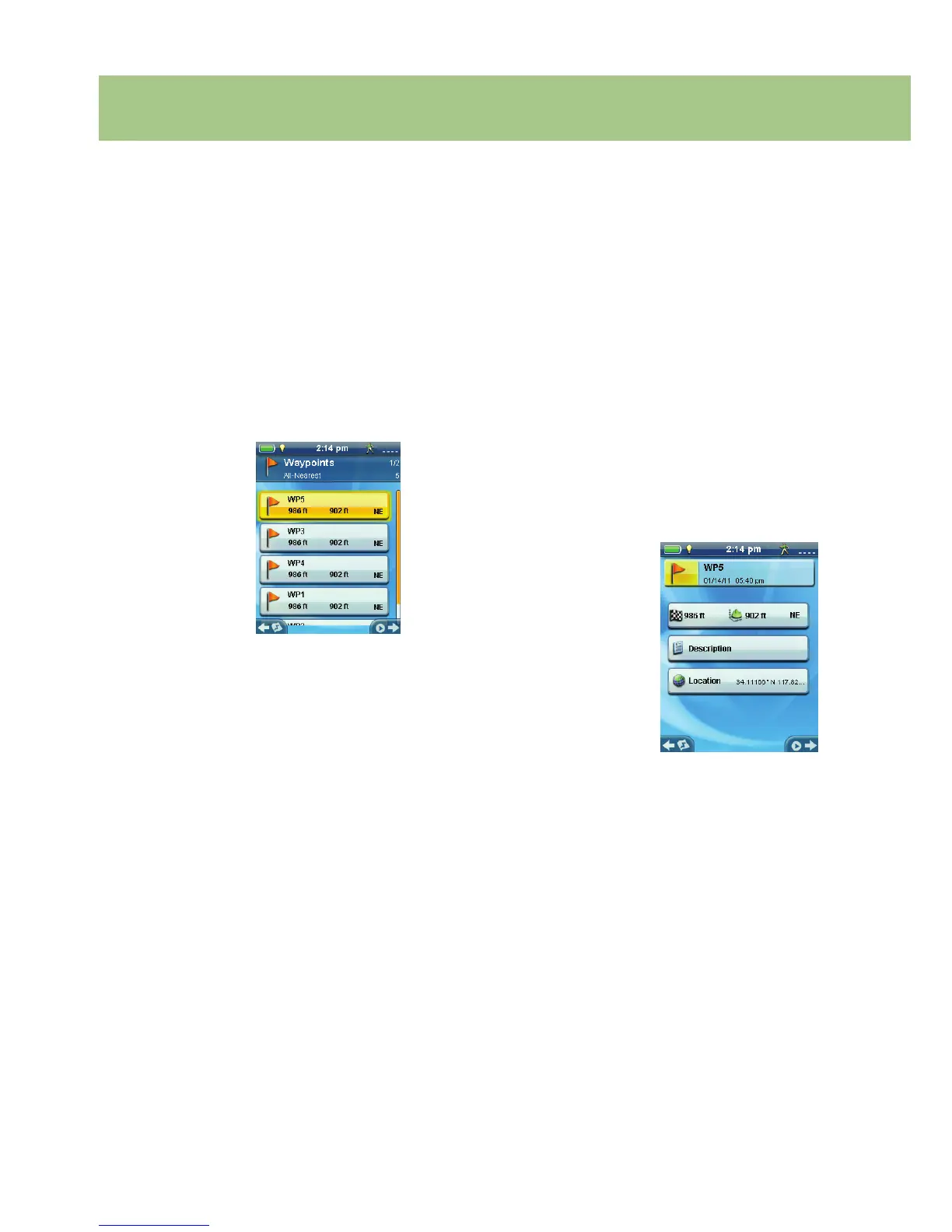
The Waypoint List
Accessing the Waypoint List
1. From the Map screen press BACK.
2. Select the Waypoints icon. All the waypoints
you have saved will be displayed as a list.
Sorting the Waypoint List
1. Access the Waypoint list.
2. Press MENU.
3. Select Sort & Search.
4. Select sort by Nearest, Date Created, Type or
Name.
Use the Show drop-down menu to select All or
just show Favorites.
5. Select the Back button to return to the list of
waypoints.
Searching for a Saved Waypoint
1. Access the Waypoint list.
2. Press MENU.
3. Select Sort & Search.
4. Select the Search by Name button.
5. Use the keyboard to enter the rst few
characters of the waypoint name being
searched.
6. Select the green checkmark.
7. The Waypoint List is displayed with the results
of the search.
Editing a Saved Waypoint
1. Access the Waypoint list.
2. Select the name of the waypoint to be edited.
3. The Waypoint Description page is displayed.
Icon: Select the waypoint icon to select a new
icon.
Name: Select the waypoint name and enter a
new name using the keyboard.
Description: Select the Description button.
Select the screen below the Description
button. Use the keyboard to enter a
description for the waypoint. Select the Back
icon when done.
Location: Select the Location button. Select
the Primary or Secondary coordinates elds.
Select the coordinated to be changed and use
the keyboard to enter the new values.