8 en
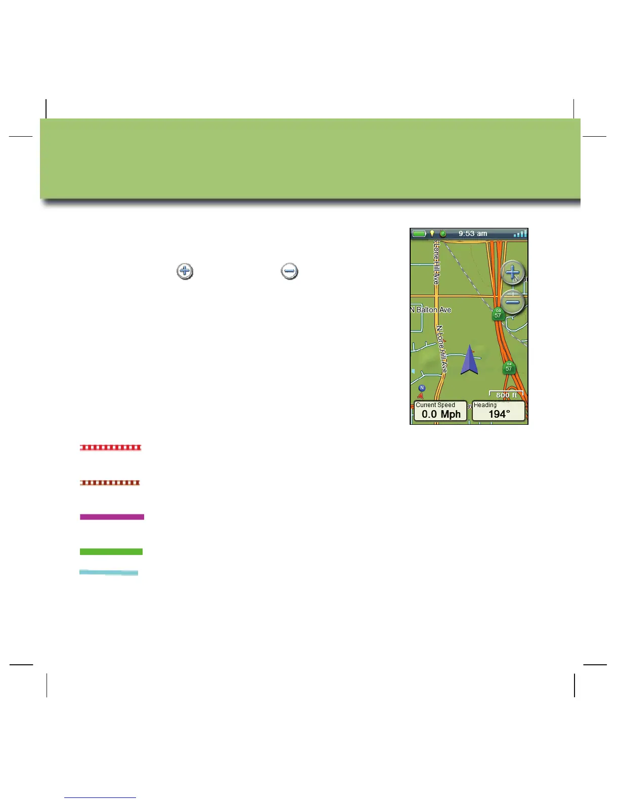
The Map screen is the starting point for using your
eXplorist GPS receiver.
Use the zoom in
and zoom out controls to
change the map scale. You can customise the
number of navigation fields from zero to four, each
of which can be set to display unique navigation
data.
Navigation lines are displayed on the map
providing you with information about your journey.
Active track Displays a history of your travels when
you are routing to a destination.
Active track Displays a history of your travels when
you are not routing to a destination.
Origin Destination
Line
Originally computed route from point of
origin to your destination.
Route Line Computed multi-leg route.
Point Destination
Line
Guidance from your current position to
the destination.
Map Screen

 Loading...


