Do you have a question about the Magellan RoadMate 2035 and is the answer not in the manual?
Check state/local laws for windshield mounting and ensure legal compliance while driving.
Minimize display viewing while driving; driver should only enter data when stopped.
Database may not reflect all road changes or restrictions; disregard unsafe route suggestions.
Choose a location with unobstructed sky view and clean the windshield before mounting.
Attach USB connector to cradle and secure cradle to windshield.
Connect vehicle power cable before first use to charge the internal battery.
Information on technical support and identification of device components like power switch.
Instructions for turning the device on and important notices regarding traffic features.
How to view and improve satellite signal reception for accurate positioning.
Details on battery operation time, charging, and servicing.
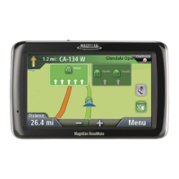
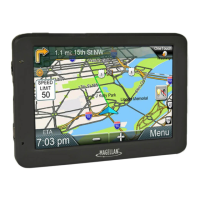
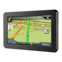
Explains elements like turn instructions, traffic icons, ETA, and navigation controls on the routing map screen.
Options for creating routes to addresses, POIs, and other destinations.
Functions available during routing, such as cancelling a trip or detouring.
Quick access to frequent destinations/searches; how to save and assign buttons.
Accessing the emergency button and editing assigned OneTouch buttons.
Feature simplifying city/street entry by predicting names and limiting character choices.
Predicts cities based on location and past routes for easier address entry.
Step-by-step guide for entering city, street name, and number for address-based routing.
Options for routing to POIs, previous destinations, address book, intersections, and city centers.
How to search for POIs by category or by entering their name.
Details the warranty period, coverage for defects in material and workmanship.
Explains remedies, purchaser responsibilities for repair, and warranty limitations.
Covers limitations of implied warranties and specific exclusions from warranty coverage.
Discusses exclusion of damages, complete agreement terms, and choice of law.
Warnings on driver distraction, mounting hazards, traffic laws, and database limitations.
Precautions for extreme temperatures, battery handling, and charging procedures.
FCC rules on interference, exposure limits, and cable requirements for compliance.
IC regulations for interference and radiation exposure limits.
IC device compliance, exposure limits, and information on document changes and trademarks.
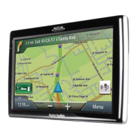
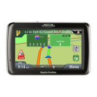
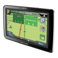
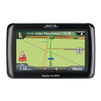
Describes the GPS navigator's purpose, key features, and user interface.
Details battery operational time, signal reception, and the inclusion of voice alerts.
Identifies the Power Switch, Power Input, and Micro SD card slot on the device.
Instructions for turning the receiver on/off and checking battery/GPS status.
How to adjust the volume from the Map screen or through settings.
Accessing Address Book, routing to intersections, city centers, and settings.
Explanation of the keypad layout and tips for efficient data entry.
Details on list/accept buttons, Smart City Search, and QuickSpell functionality.
Feature that simplifies city/street entry by predicting names and grey-out invalid characters.
Tips for choosing a mounting location and cleaning the windshield before mounting.
Steps for attaching the power cable and securely mounting the car cradle.
Attaching the receiver to the cradle, adjusting the mount, and connecting power.
Operating the power switch and security recommendations for the device.
Explains Normal and Routing modes, detailing key display elements and controls.
How to switch between 2D/3D views, adjust zoom levels, and pan the map.
Setting a destination by tapping a point on the map after panning.
Displays location data and steps to save it to the Address Book or OneTouch menu.
Viewing route maneuvers, excluding them, and adjusting volume from the map screen.
How to adjust audio volume through the device's Settings menu.
Step-by-step guide for entering city, street name, and number for address-based routing.
Quick tips for entering addresses, including using the List button and ZIP codes.
Methods for creating routes to street intersections or city geographical centers.
Accessing past routes, saving them to the address book, and clearing lists.
Selecting and routing to addresses stored in the Address Book.
Adding new addresses or POIs to the Address Book.
Saving addresses or POI searches to OneTouch buttons for quick access.
Modifying existing OneTouch assignments and saving POI search criteria.
How to initiate navigation to a saved address or search using a OneTouch button.
Searching and routing to POIs by category or using the AAA TourBook database.
Searching for POIs by name and accessing services near highway exits.
Setting or modifying the Home Address for quick navigation access.
Initiating navigation to the saved Home Address from the OneTouch menu.
Understanding the map display during a route and accessing the maneuver list.
Selecting route types, changing routing methods, and setting defaults.
Procedures for cancelling a route or finding alternate routes using Detour.
Automatic detour feature for freeway traffic jams.
Adding multiple destinations to a route using Go To options.
Reordering, optimizing, and managing destinations within a multi-destination route.
Storing multi-destination routes in the Address Book for later use.
Definitions of traffic terms and how traffic incidents are displayed on the map.
Options for avoiding traffic delays and understanding traffic icon indicators.
Navigating system settings, changing languages, and configuring auto power options.
Adjusting display brightness, time format, and selecting the time zone.
Selecting units of measure and configuring the automatic night map display.
Setting map orientation, POI visibility, auto zoom on turns, and highway lane assist.
Adjusting volume, muting sound, and turning off button sounds.
Setting default route method, turn warning sounds, U-turn guidance, and avoiding toll roads.
Selecting keyboard layout and adding new features or software updates.
Enabling traffic, setting GPS position, and viewing GPS status.
Restoring settings to factory defaults and backing up/restoring user data.
Downloading Content Manager for software updates and registration.
Special offer for new customers to register their device and receive accessory discounts.
Using Content Manager to download and install the latest map updates.
Steps for updating maps and details on the terms of lifetime map updates.
| Auto | Yes |
|---|---|
| Marine (chartplotters, sounders) | - |
| Address input | City |
| Spoken street names | Keep your eyes on the road while your GPS announces turn-by-turn directions, including street and place names. |
| Form factor | Fixed |
| Product color | Black |
| Map coverage | USA |
| Map view options | 2D/3D |
| Display diagonal | 4.3 \ |
| Placement supported | Horizontal |
| Storage media type | Flash |
| Bluetooth | No |
| USB 2.0 ports quantity | 1 |
| Power source type | Battery |
| Battery life (max) | 2 h |
| Operating temperature (T-T) | -10 - 70 °C |
| Cables included | AC |
| Antenna type | Multidirectional Patch |
| Depth | 16 mm |
|---|---|
| Width | 128 mm |
| Height | 83 mm |
| Weight | 147.4 g |