GNSS Module Series
LC29H(AA,BA,CA,DA,EA)_EVB_User_Guide 18 / 24
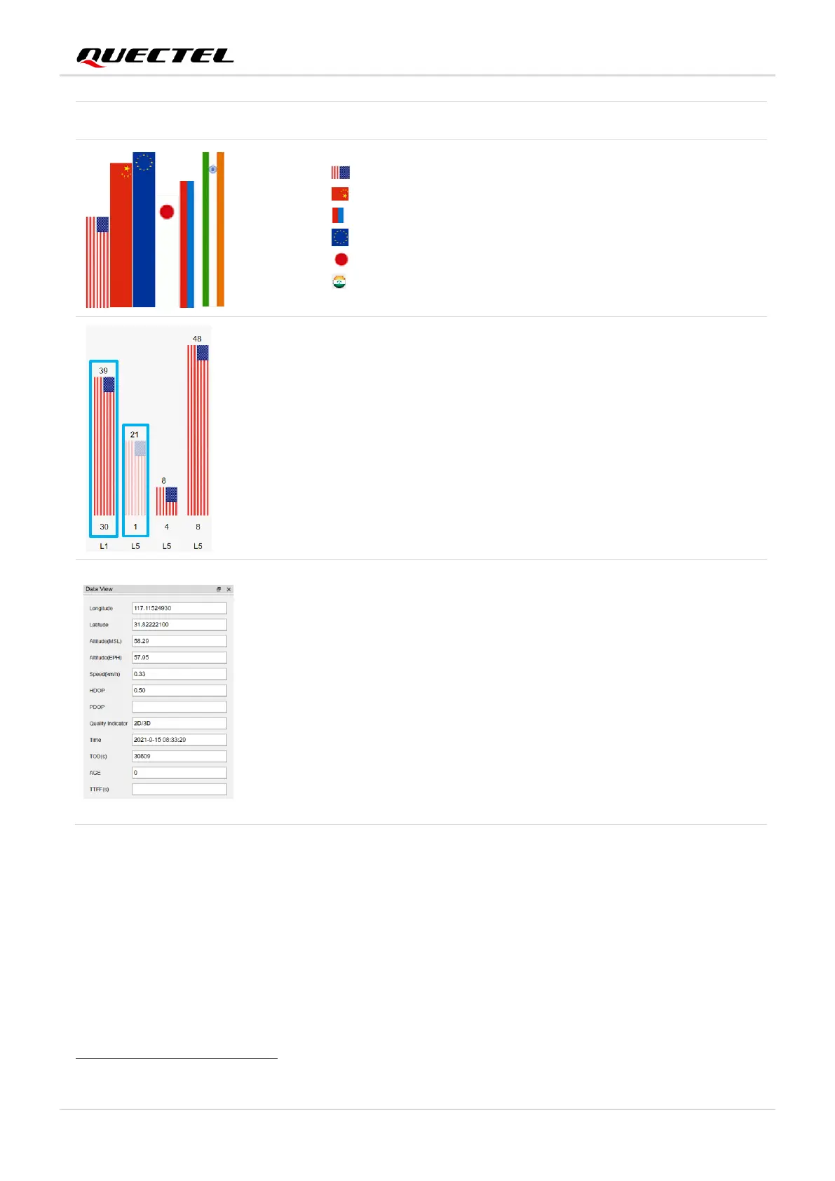
⚫ PRN 30 C/N
0
is 39 dB-Hz.
⚫ Column in bright red means that the navigation data of the
satellites are in use.
⚫ PRN 1 C/N
0
is 21 dB-Hz.
⚫ Column in light red means that the navigation data of this
satellite is not in use.
⚫ Longitude (unit: degree)
⚫ Latitude (unit: degree)
⚫ Altitude (MSL) (unit: m)
⚫ Altitude (EPH) (unit: m)
⚫ Receiver speed (unit: km/h)
⚫ Horizontal dilution of precision
⚫ Position dilution of precision
⚫ Quality Indicator: 2D/3D
⚫ UTC date and time
⚫ Time of day
3
(unit: second)
⚫ Age of differential GPS data
⚫ Last TTFF(s) (unit: second)