Do you have a question about the Raymarine RC435i and is the answer not in the manual?
Describes the purpose of the handbook and introduces the chartplotter.
Explains formatting, symbols, and terminology used throughout the manual.
Specifies the product's intended purpose for marine navigation.
Information on product registration and warranty benefits.
Disclaimer regarding the accuracy of information and potential updates.
Statement regarding electromagnetic compatibility standards.
Cautionary advice regarding installation compliance to prevent damage or injury.
Advises using the product as an aid and not replacing navigational judgment.
Warning about high voltages and the need for qualified service technicians.
Provides contact details for Raymarine support and service.
Lists the key features and capabilities of the RC435/435i chartplotter.
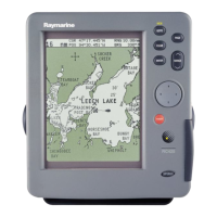
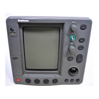
Describes the chartplotter's controls and main display elements.
Explains how to use the trackpad and cursor for chart navigation.
Details the functions of the chartplotter's fixed hardware buttons.
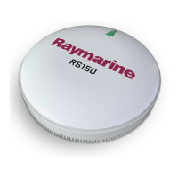
Introduces satellite differential correction systems for GPS accuracy.
Recommendations for ensuring optimal Electromagnetic Compatibility during installation.
Instructions for checking the contents of the chartplotter package.
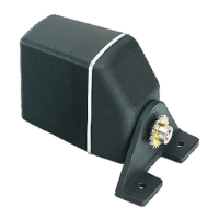
Guidance for mounting the external GPS antenna for the RC435.
General considerations for installing the chartplotter unit on a vessel.
Step-by-step instructions for mounting the unit using the bracket.
Instructions for flush mounting the chartplotter into a panel.
Guidance on routing power and data cables safely and effectively.
Details for connecting the power and NMEA interface cable.
Procedures for verifying installation and powering up the unit.
Introduction to the simulator mode for practicing operation.
Instructions on how to power the chartplotter unit on and off.
Guidance on managing display modes and settings.
Techniques for navigating and repositioning the chart display.
Information on using electronic chart cards for detailed navigation.
Overview of general system configuration and default settings.
Configuration options specific to the chart display and data.
Setting the chart display orientation (North Up, Course Up, Head Up).
Information on GPS status and system reset options.
Procedures for placing, selecting, editing, and erasing waypoints.
Guide to creating, saving, editing, and managing navigation routes.
Instructions for navigating routes or heading to specific destinations.
Selecting and customizing different screen views for data display.
Methods for exchanging waypoint and route data with other devices.
Recording and managing the vessel's path and converting tracks to routes.
Accessing detailed data for objects displayed on the chart.
Displaying tidal height and current data for specific locations.
Procedure for initiating the Man Overboard function in emergencies.
Descriptions of system alarms and how to manage them.
General maintenance procedures and routine checks for the unit.
Procedures for performing power-on and factory resets.
Common problems and solutions for diagnosing and fixing faults.
Information on contacting Raymarine for support and service.
Details on NMEA data protocols transmitted and received by the unit.