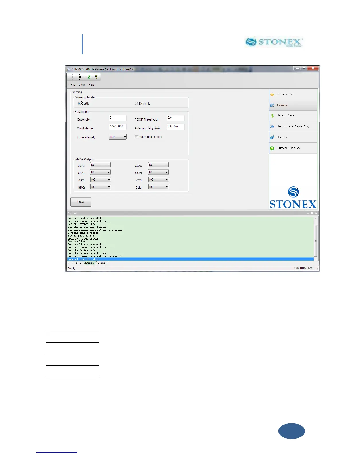
Fig. 5.5 – Static working mode
From here you can control following data settings:
Cut Angle : Define the minimum elevation of Satellite on (suggested value = 15)
PDOP Threshold : Define the maximum value of PDOP for valid GPS data.
Point Name : Assign a “name” to the point you are surveying.
Antenna Height : Introduce GPS antenna height from ground, see Par IV.5 .
Time Interval : Set time between different GPS epochs.
 Loading...