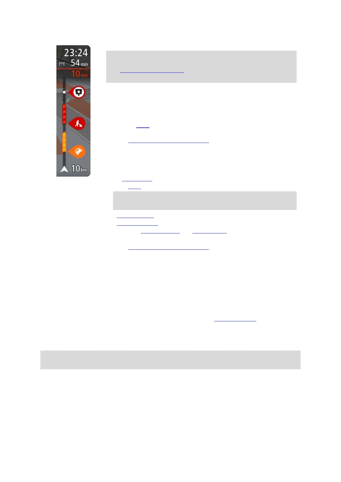
27
The arrival information panel shows the following information:
Tip: If your destination is in a different time zone, you see a plus (+)
or a minus (-) sign and the time difference in hours and half hours in
the arrival information panel. The estimated time of arrival is the
local time at your destination.
The estimated time that you will arrive at your destination.
The length of time to drive to the destination from your current
location.
A parking button is shown near the destination flag when parking is
available near your destination.
If you have stops
on your route, select this panel to change between
information about the next stop and your final destination.
You can choose the information you see on the arrival information panel.
Traffic status - if your TomTom GO Camper isn't receiving any traffic
information, a symbol showing traffic with a cross appears underneath
the arrival information panel.
The bar uses symbols to show the following information:
A faster route
, if there is traffic on your route.
The stops on your route.
Tip: To quickly remove a stop, select it in the route bar and use the
pop-up menu.
Petrol stations that are directly on your route.
TomTom Traffic incidents.
TomTom Speed Cameras and Danger Zones.
Rest stops directly on your route.
You can choose the information you see
on your route.
The symbols are in the order that they occur on your route. For traffic
incidents, the symbol for each incident alternates between showing the
type of incident and the delay in minutes. Select a symbol to see more
information about a stop, an incident or a speed camera. If a symbol is
shown on top of another symbol, selecting the symbols zooms in on the
route bar to show each symbol separately. You can then select a symbol.
The total time delay due to traffic jams, weather, and other incidents on
your route, including information provided from historical road usage, is
shown above the symbols.
For a complete list of incident types, see Traffic incidents
.
The bottom of the route bar represents your current location and shows
the distance to the next incident on your route. In addition, you can
choose to see the current time if you switch the setting on.
Note: To make the route bar more readable some incidents may not be shown. These incidents
will always be of minor importance and only cause short delays.
The route bar also shows status messages, for example Finding fastest route or Playing route
preview.
Distances and the route bar
The distance ahead shown on the route bar depends on the length of your route, or the distance
remaining on your route.