information about a stop, an incident or a speed camera. If a symbol is
shown on top of another symbol, selecting the symbols zooms in on the
route bar to show each symbol separately. You can then select a symbol.
The total time delay due to traffic jams and other incidents on your route,
including information provided by IQ Routes, is shown above the symbols.
For a complete list of incident types, see Traffic incidents.
The bottom of the route bar represents your current location and shows
the distance to the next incident on your route.
Note: To make the route bar more readable some incidents may not be shown. These incidents will
always be of minor importance and only cause short delays.
The route bar also shows status messages, for example Finding fastest route or Playing route
preview.
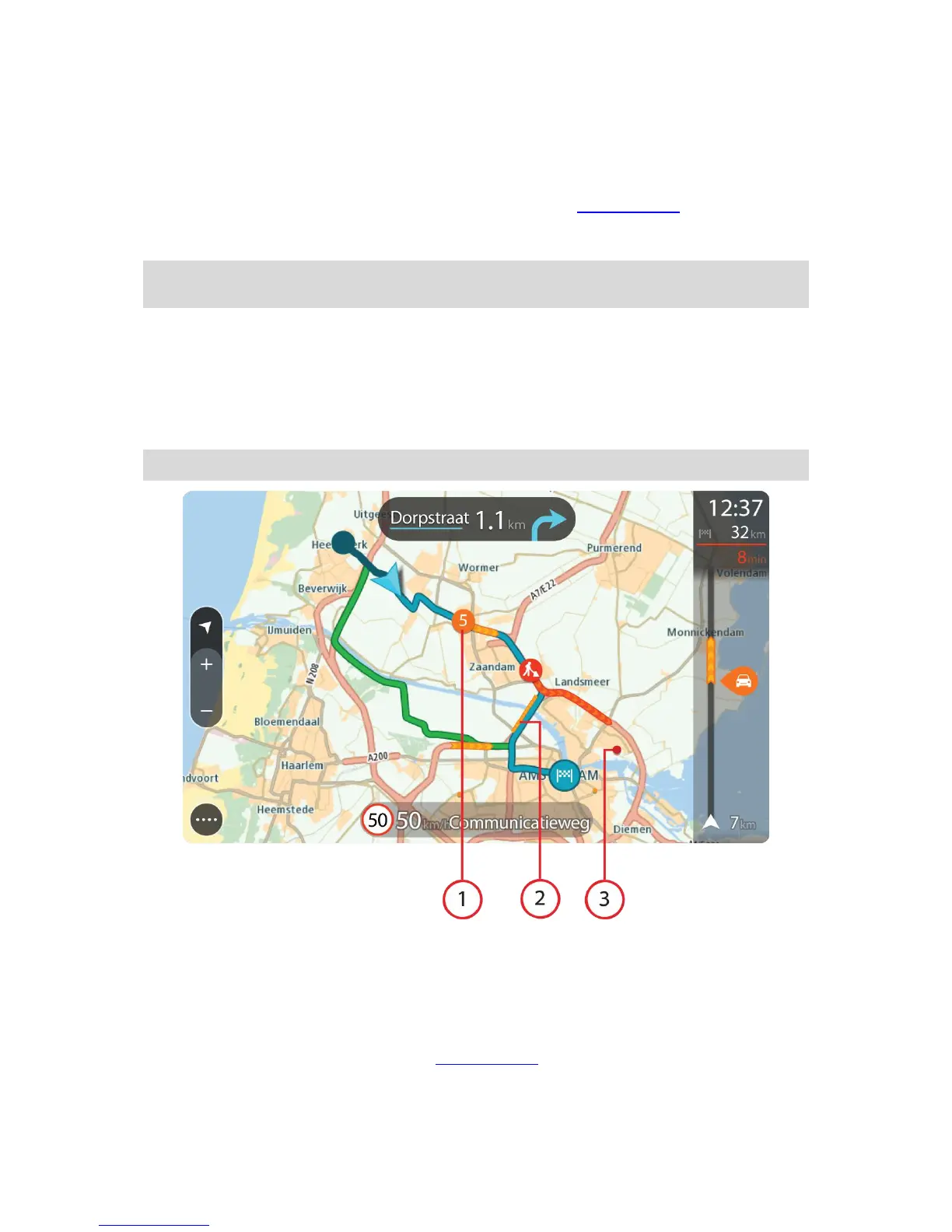
Looking at traffic on the map
Traffic incidents are shown on the map. If several traffic incidents overlap the highest priority incident
is shown - for example, a road closure is higher priority than road works or a closed lane.
Tip: Select an incident on the map to see more detailed information.
1. Traffic incident that affects your route in your direction of travel.
A symbol or number at the start of the incident shows the type of incident or the delay in minutes,
for example 5 minutes.
The colour of the incident indicates the speed of traffic relative to the maximum allowed speed at
that location, with red being the slowest. The stripes on the traffic jam are also animated to show
the speed of the traffic, where appropriate.
For a complete list of incident types, see Traffic incidents.
2. Traffic incident on your route but in the opposite direction of travel.
3. Traffic incidents on roads that are not visible at your current zoom level.
 Loading...