– 14 –
◗ 2nd LEG SOLUTION: The blue circle on the left
side of the screen indicates inputs for Leg 1. Press:
and tap enter to input the distance of
57.3 NM, then
and tap enter to input the true course of
170°, then
and tap enter to input the true airspeed
of 110 KTS, then
and tap enter to input wind direction,
then
and tap enter to input the wind speed of 6 KTS,
then
and tap enter to input -17° for the
variation, then
and tap enter to input the deviation of 0°, and
then nally
and tap enter to input the fuel rate of 9.5
U.S. GPH.
Make sure the departure time shows 12:51:00 UTC.
Press , scroll down to Leg 3 and tap enter.
Given for Leg 3:
Distance between W04 and KRNT: 84.2
nautical miles
True Course between W04 and KRNT: 069°
Wind Direction is 140° at 5 KTS
◗ 3rd LEG SOLUTION: The blue circle on the left
side of the screen indicates inputs for Leg 2. Press:
and tap enter to input the distance
of 84.2 NM, then
and tap enter to input the true course of
069°, then
and tap enter to input the true airspeed
of 110 KTS, then
and tap enter to input wind direction,
then
and tap enter to input the wind speed of 5 KTS,
then
and tap enter for -17° variation, then
and tap enter to input the deviation of 0°, and
then nally
and tap enter to input the fuel rate of 9.5
U.S. GPH.
The last step is to make sure the departure time
shows 13:23:49 UTC. Press , scroll up to Total
Trip and tap enter. The totals for the trip are distance
233.8 NM, estimated time enroute 2:10:29 HMS,
estimated time of arrival 14:10:29 UTC, and fuel used
20.66 U.S. GAL.
BACK
BACK
0
0
56
9 . 5
9 . 5
1 4 0
1 1 0
1 7 0
1 1 0
2 0 0
5 7 . 3
8 4 . 2
6 9
1 7
+
−
1 7
+
−
CX
-
3
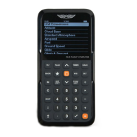
Flight Computer
PLAN (TRIP FUNCTIONS) CONTINUED