FlightMax EX5000 -34- 600-00105-000 Rev 01
Appendix - Tables
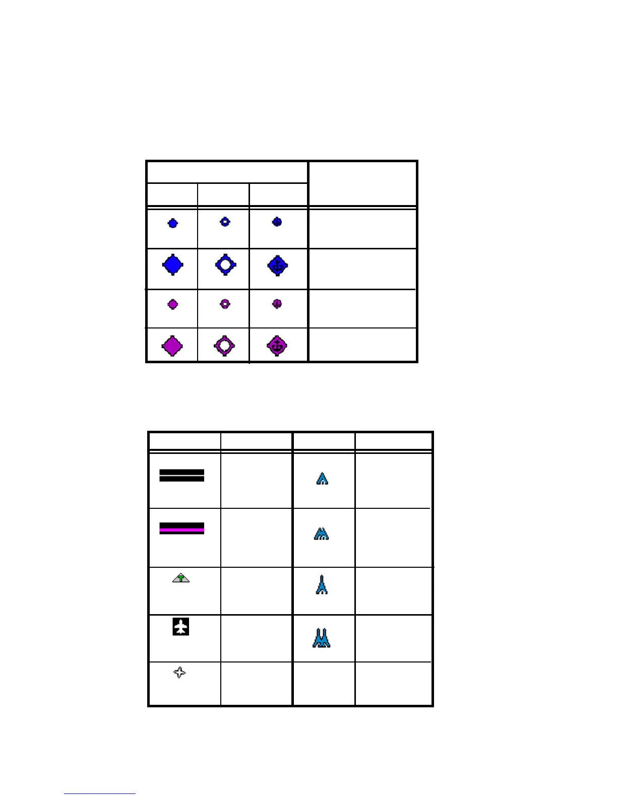
NOTE: The various airport types are derived directly from the Jeppesen navigation
database.
Table 3: Map Symbols - Airports
NOTE: The larger airport symbols are displayed as the map scales are
reduced to the smaller ranges.
Table 4: Map Symbols - Other
* -If all legs are shown in white, the GPS is not reporting the active leg
of the flight plan.
Symbol Item Symbol Item
Flight Plan Single Low
(inactive leg)* Obstacle
>= 200’ AGL
<1000’ AGL
Flight Plan Low Obstacles
(active leg) within 1NM of
eachother
>= 200’ AGL
<1000’ AGL
Map Orientation Single Obstacle
>=1000’ AGL
Ownship Obstacles
Symbol within 1NM of
eachother
>=1000’AGL
Flight Plan,
Course
Waypoints
Surface Airport Type
Hard Soft Water
Towered
Towered
Non-Towered
Non-Towered