Appendix B. Determining True
North and sensor orientation
Orientation of the wind direction sensor is done after programming the data logger, and
determining the location of True North. True North is usually found by reading a magnetic
compass and applying the correction for magnetic declination; where magnetic declination is the
number of degrees between True North and Magnetic North. The preferred method to obtain
the magnetic declination for a specific site is to use a computer service offered by NOAA at
www.ngdc.noaa.gov/geomag. The magnetic declination can also be obtained from a map or
local airport. A general map showing magnetic declination for the contiguous United States is
shown in FIGURE B-1 (p. 39).
Declination angles east of True North are considered negative, and are subtracted from 360
degrees to get True North as shown FIGURE B-2 (p. 39) (0° and 360° are the same point on a
compass). For example, the declination for Logan, Utah is 11.78° East (11 August 2015). True North
is 360° – 11.78°, or 348.22° as read on a compass. Declination angles west of True North are
considered positive, and are added to 0 degrees to get True North as shown in FIGURE B-3 (p.
40).
Orientation:
1. Establish a reference point on the horizon for True North.
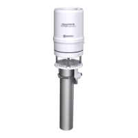
2. Sighting down one pair of the ClimaVUE 50 north south posts, aim the pair at True North.
If the wind is blowing and a flag or banner can be used to determine the true wind
direction, the data logger displayed wind direction reading can be compared to the true
wind direction.
ClimaVUE 50 Compact Digital Weather Sensor 38
 Loading...