Calibration
5-12
Tracking for satellite elevation between 5 and 75 degrees
When the VSAT system has found the satellite and is in pointing mode, the performance
of a system with heading input and a system without heading input will be very similar.
Note that this is only the case for a satellite elevation range from 5 to 75 degrees.
If the satellite is an inclined orbit satellite, the missing heading information introduces a
polarization error depending on the satellite elevation and the inclination. Normally it is
required that the polarization is controlled within 1 degree towards the satellite. This gives
the following limit for use of inclined orbit satellites (a purely physical limit), and all
systems without heading input have this limit.
Tracking for satellite elevation above 75 degrees
It is not possible to use a system without heading input from the vessel's gyro compass
with satellites at an elevation of higher than 75 degrees because the system will not have
the required polarization accuracy of the transmitted signal.
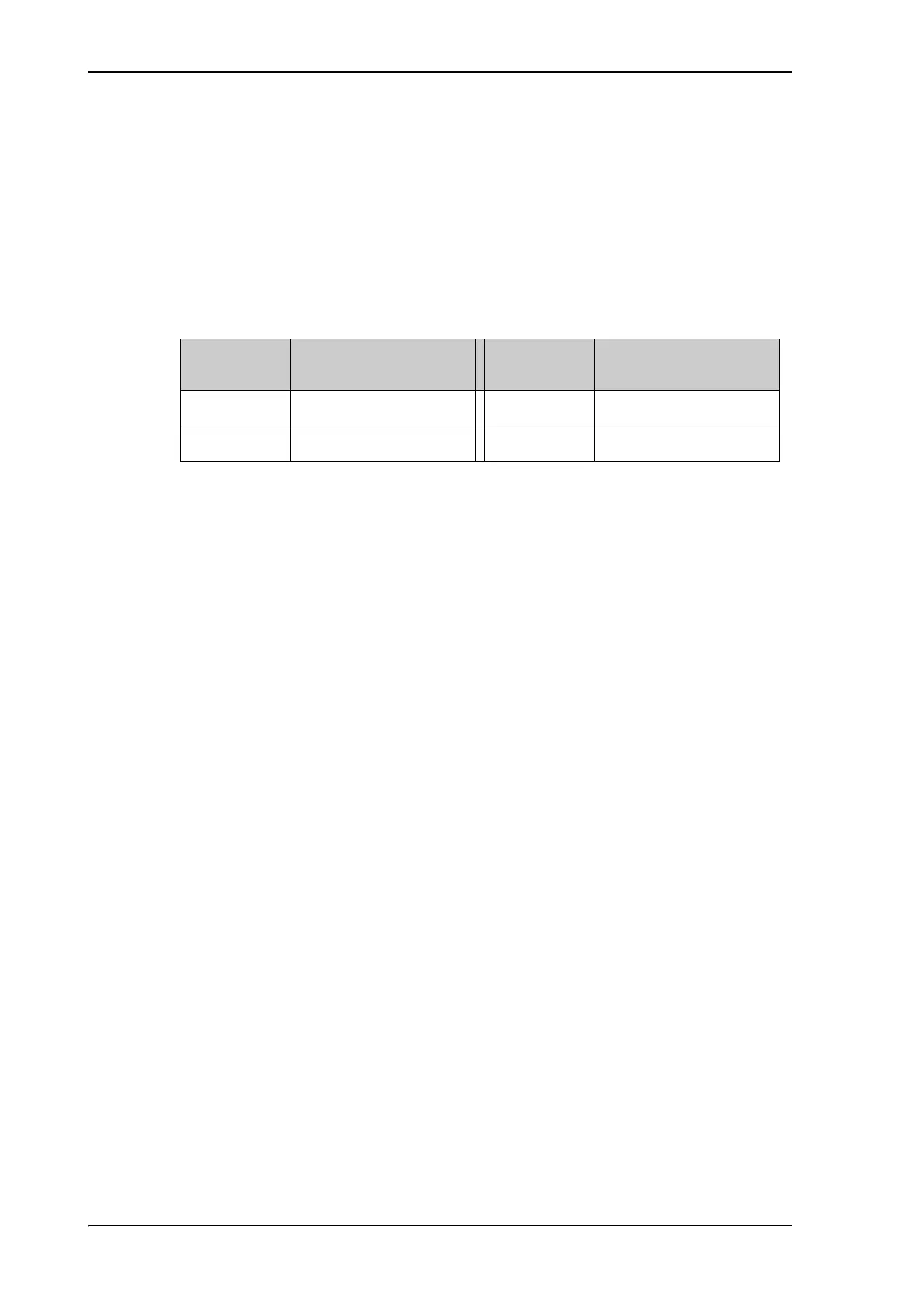
Satellite
elevation
Max allowed inclination
Satellite
elevation
Max allowed inclination
<20 2.5 <70 0.3
<50 0.7 ≤75 0
Table 5-7: Satellite elevation and max. allowed inclination