3. PLOTTER OPERATION
3-43
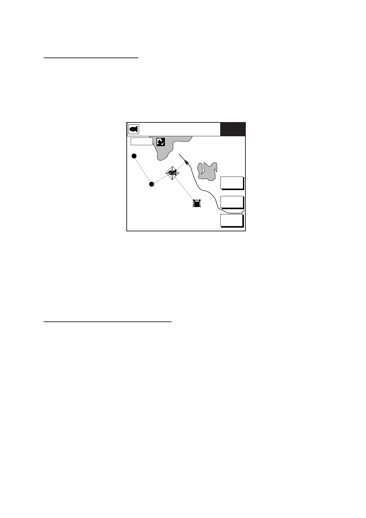
3.10.4 Following a route
Selecting the route to follow
1. Press the MENU key to open the menu.
2. Press the WAYPOINTS/ROUTES soft key.
3. Press the ROUTES soft key to open the route list.
4. Select a route.
5. Press the GOTO soft key to show the plotter display. The cursor is on the waypoint
nearest own ship.
WPT002
WPT001
FISH
CRAB
GOTO
ROUTE
GOTO
WPT
RVRSE
ROUTE
RETURN
16.0 nm
359.2°M 104.5°M
TRIP
83.2nm 10.0 kt
FISH
0.7
Plotter display, route selected as destination
6. Operate the Trackball to place the cursor on the waypoint or leg in the route from where
to start navigating the route.
7. Press the GOTO WPT or FOLLOW LEG soft key, depending on the action taken at step
A solid blue line runs between own ship and first waypoint. Green dashed lines connect all
other waypoints. The arrows on the lines show the direction to traverse the route.
Navigating waypoints in reverse order
Press the RVRSE ROUTE soft key followed by the ENTER knob to navigate waypoints in
reverse order. The arrows on the route line point in the direction selected.
 Loading...