2. CHART PLOTTER
2-6
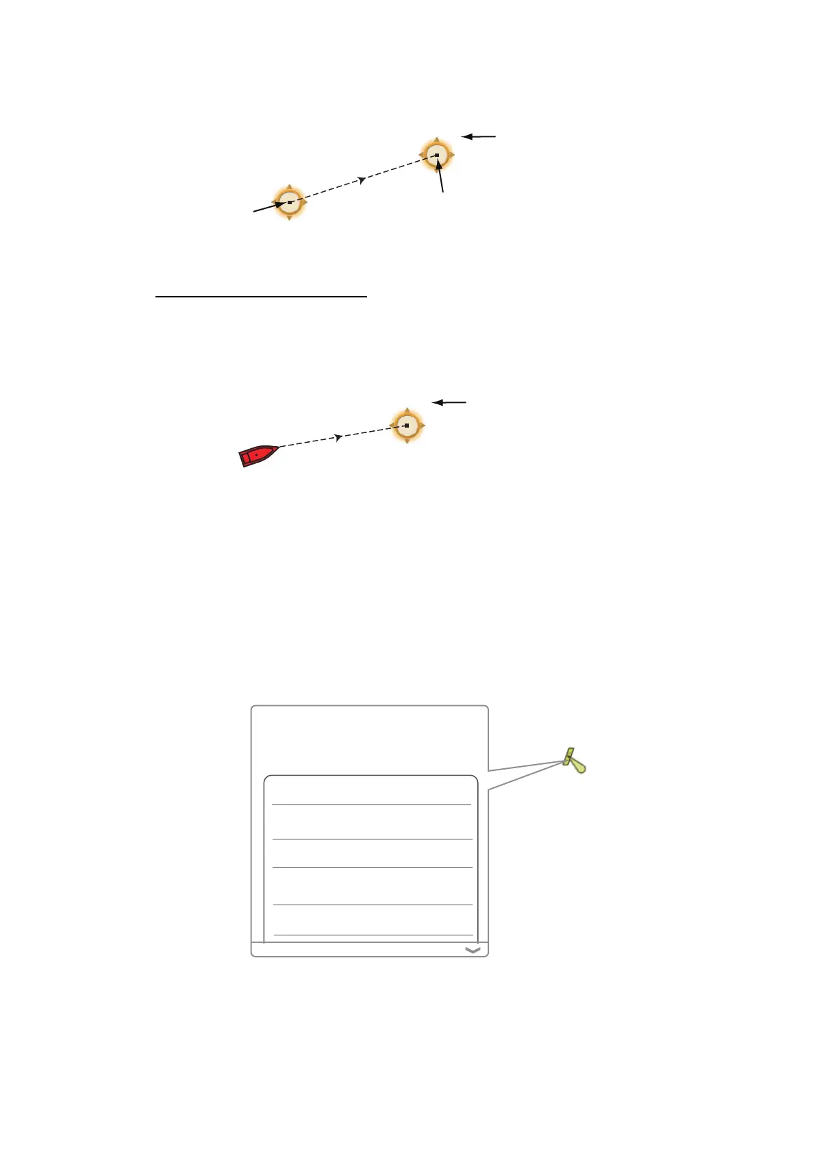
3. Select the 2nd location. A dashed line runs between the start location and the 2nd
location. The range and bearing to the 2nd location are shown.
4. Select [Cancel Ruler] at the top right-hand corner of the screen to erase the indi-
cation.
From your ship to a location
1. Select the location then the pop-up menu appears.
2. Select [Dist. to Boat]. A dashed line runs between the boat icon and the selected
location. The range, bearing and the time to go to the selected location are shown.
3. Select [Cancel Ruler] at the top right-hand corner of the screen to erase the indi-
cation.
2.7 Chart Object Information
Vector charts show many objects, like buoys and lighthouses, for which you can find
the information. Port, tide and current information are available if the chart contains
this information.
Select any chart object to find the information.
Range and bearing from starting
location to the 2nd location
M: Magnetic
8.765NM
76.4°M
8.765NM
76.4°M
Starting location
2nd location
Range, bearing and
time to go to point
M: Magnetic
11.38NM
56.6°M
1h23’
Your ship
By, special purpose
Shape pillar
Category
TSS mark (Traffic
Separation Scheme)
Color yellow
Name
Puget Sound Traffic Lane
Separation Lighted Buoy T
S57 Object Info
Source date 10/10/2012
 Loading...