Garmin aera 660 Pilot’s Guide
190-02017-20 Rev. E
123
Hazard Avoidance
Overview Navigation Flight Planning Hazard Avoidance Additional Features Appendices Index
sAlert Sensitivity—The three Alert Sensitivity settings (Terrain, Obstacle, and Descent
Rate) determine what level of alerts are annunciated. The aera 660 defaults to
‘High’ sensitivity, which annunciates all red and yellow alerts at the time set in
Look Ahead Time. ‘Medium’ sensitivity annunciates all of the red and the highest
priority of yellow alerts. ‘Low’ only annunciates red alerts. ‘Off’ disables the alert.
Accessing terrain/obstacle settings:
1)
From the Main Menu, touch Terrain.
2)
Touch Menu.
3)
Touch Caution Elevation, and touch 500ft Below, 750ft Below, or
1000ft Below.
4)
Touch Look Ahead Time, and touch 60 Seconds, 90 Seconds, or 120
Seconds.
5)
Touch Terrain 'Alert Sensitivity', and touch Off, Low, Medium, or High.
6)
Touch Obstacles 'Alert Sensitivity', and touch Off, Low, Medium, or
High.
7)
Touch Descent Rate 'Alert Sensitivity', and touch Off, Low, or High.
Terrain, Obstacle, and Descent Rate Alerts are issued when flight conditions meet
parameters that are set within the software algorithms. Terrain alerts typically employ
a CAUTION or a WARNING alert severity level, or both. When an alert is issued, visual
annunciations are displayed and aural alerts are simultaneously issued. When the
aircraft descends through 500 feet above the destination airport an audible “Five
Hundred” altitude reminder occurs.
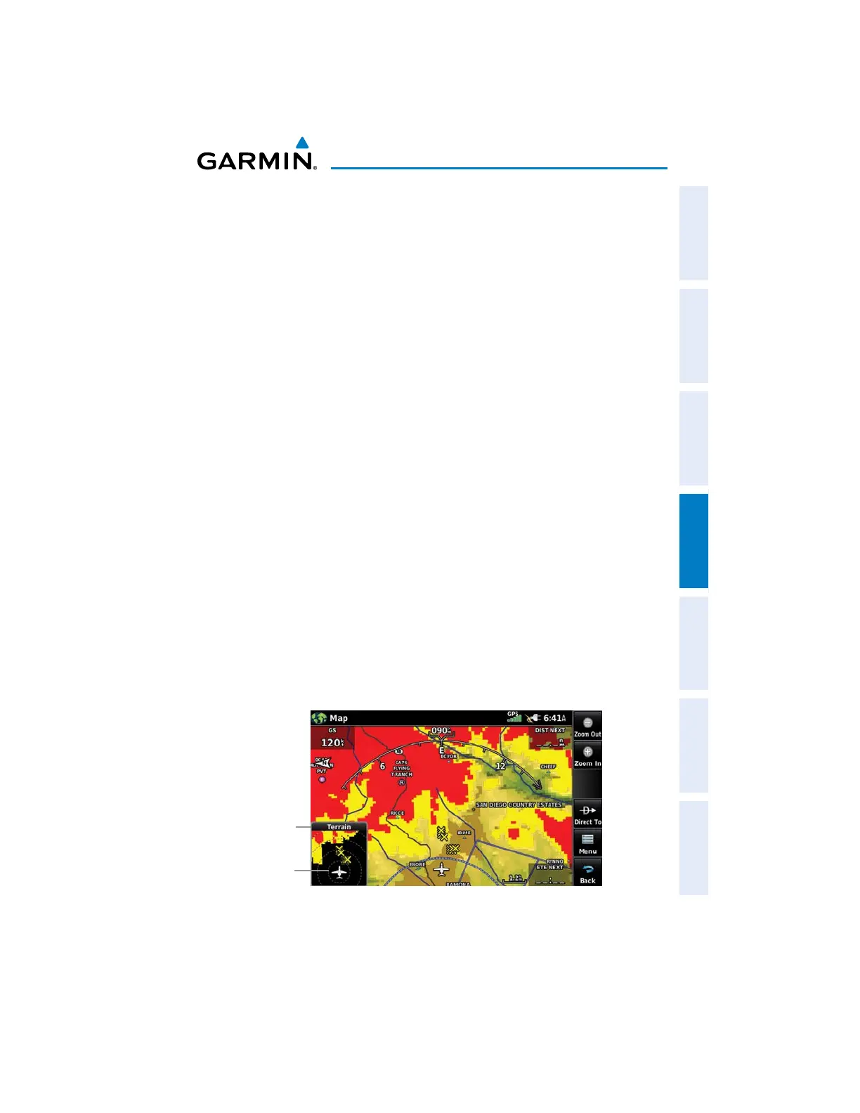
The Terrain Alert Annunciation is shown to the lower left corner of the screen. If the
Terrain Map is not displayed, a pop-up alert appears. The Range Rings on the pop-
up alert are spaced every whole mile/kilometer/nautical mile. Touch the Terrain Alert
Annunciation to acknowledge the pop-up and/or aural alert.
Pop-up
Alert
Pop-up Alert (Navigation Map With Terrain Shading)
Range
Rings

 Loading...


