


Do you have a question about the Garmin Astro and is the answer not in the manual?
Instructions on how to contact Garmin for support and assistance with the product.
Provides quick tips for navigating the menu and extending battery life.
Important safety information regarding vehicle installation and distracted driving.
Information on accessing Garmin services, registering the unit, and managing product features online.
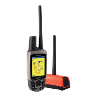
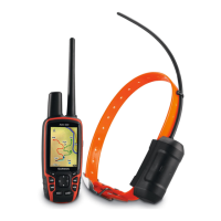
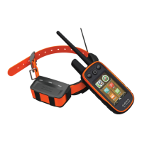
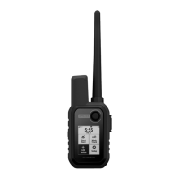
Identifies and labels key components of the Astro 220 unit.
Step-by-step instructions for installing batteries and attaching the lanyard.
Explains the function of each button on the Astro 220 keypad for operation.
Instructions on powering the unit on/off and adjusting the display backlight.
Instructions for charging the DC 20 and initializing GPS receivers.
Steps to calibrate the electronic compass for accurate direction readings.
Defines key terms and conventions used throughout the manual for clarity.
Explains the icons and information displayed on the unit's status bar.
How to ensure the DC 20 is communicating with the Astro 220 for tracking.
Lists options available from the Dog Info page for managing tracking.
Specific steps to view dog tracking data on the Dog Tracker page.
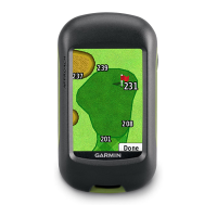
How to view a dog's location and your own on the Map page.
How to handle and resolve ID conflicts when tracking multiple dogs.
Advice for optimal dog tracking performance, including battery and signal considerations.
Resets dog statistics, track logs, and marks the current vehicle location.
Navigates the user to a previously marked location.
Provides predicted best times for hunting and fishing based on date and location.
How to quickly mark new locations using the MARK key.
Creating a location by panning and marking an item on the Map page.
How to modify existing marked locations by changing details.
Creating a new location by using bearing and distance from a marked point.
Customizing the Map page display using various menu options.
Adding and configuring data fields on the Map page for travel information.
Detailed steps on how to measure distances between points on the map.
Locating saved items or points of interest by their name.
Accessing a list of all saved locations.
Searching for cities within the unit's mapping database.
Searching for specific addresses using downloaded map data.
Locating restaurants, landmarks, and other points of interest.
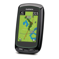
Displays travel statistics like speed, distance, and odometer.
Guides navigation with a compass display and navigation data.
Displays current elevation, ascent/descent rates, and elevation profiles.
Creating and managing electronic bread crumb trails or track logs.
Using saved tracks for TracBack navigation.
Creating and navigating custom routes with turn-by-turn directions.
Shows receiver status, satellite signal strength, and location.
Viewing archived locations and planning activities.
Accessing the built-in standard and scientific calculator.
Using the device as a stopwatch with lap timing.
Accessing built-in games for entertainment.
Configuring basic unit settings like GPS, WAAS, and battery type.
Managing the list of linked dogs and their information.
Customizing screen display, backlight, and brightness.
Adjusting how items are displayed on the Map page.
Customizing routing preferences and behavior.
Calibrating compass and altimeter for accuracy.
Detailed technical specifications of the Astro 220 and DC 20.
Instructions for connecting the unit to a computer via USB.
Saving and viewing tracks from the Astro 220 in MapSource software.
Cleaning and maintenance instructions for the device.
Compliance information regarding FCC rules and RF exposure.
Terms and conditions of the product's limited warranty.
| Battery life (max) | 24 h |
|---|
| Depth | 32 mm |
|---|---|
| Width | 57 mm |
| Height | 159 mm |
| Weight | 185 g |