Do you have a question about the Garmin Alpha 300 and is the answer not in the manual?
Steps to set up the Alpha system, including charging devices and pairing.
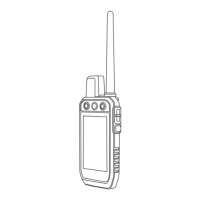
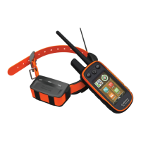
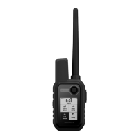
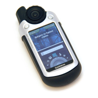
Visual guides and descriptions of the Alpha handheld and dog collar devices.
Explains various methods like MURS/VHF, track/control codes, and wireless pairing.
Instructions on how to properly fit the collar on your dog for effective training.
View your dog's location in real-time on the map interface.
Explanation of icons indicating the dog's current activity or status.
Details on momentary, continuous stimulation, tone, and vibration training options.
Send and receive text messages using the Iridium satellite network.
Record and transmit track points over the Iridium satellite network.
Procedure to contact emergency services and request assistance.
Connect your smartphone via Bluetooth for additional features and app integration.
Save your truck's location to navigate back to it after the hunt.
Learn to mark, save, and manage locations on the device.
Create, edit, and navigate sequences of waypoints.
Record, view, and manage your path history.
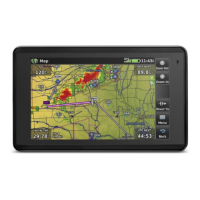
View your location, tracks, and waypoints on the map.
Ensure accurate heading by calibrating the electronic compass.
Create alerts for when you or your dogs enter a specified radius.
Personalize the order and content of the main menu items.
Configure device settings like satellite system, language, and units.
Information on obtaining software updates, FAQs, and customer support.
Technical details for the Alpha handheld device, including battery and range.
Instructions for installing a microSD card for additional storage.
Information on purchasing optional accessories and replacement parts.
| Display resolution | 240 x 400 pixels |
|---|---|
| Water rating | IPX7 |
| High-sensitivity receiver | Yes |
| Memory/History | 16 GB |
| Ability to add maps | Yes |
| Pro View Compass | Yes |
| BaseCamp™ compatible | Yes |
| Automatic routing (turn by turn routing on roads) | Yes |
| GPS | Yes |
| Display type | color TFT |
| Battery type | Rechargeable lithium-ion |
| Preloaded maps | Yes |
| External memory storage | microSD™ card |
| Waypoints/favorites/locations | Yes |
| Tracks | Yes |
| Track log | Yes |
| Routes | Yes |
| Dog tracking | Yes (with compatible dog devices) |
| Compatibility | Dog tracking collars |
| Connectivity | Bluetooth, ANT+ |