Garmin aera 660 Pilot’s Guide
190-02017-20 Rev. E
138
Hazard Avoidance
OverviewNavigationFlight PlanningHazard AvoidanceAdditional FeaturesAppendicesIndex
TARGETTREND ON MAP
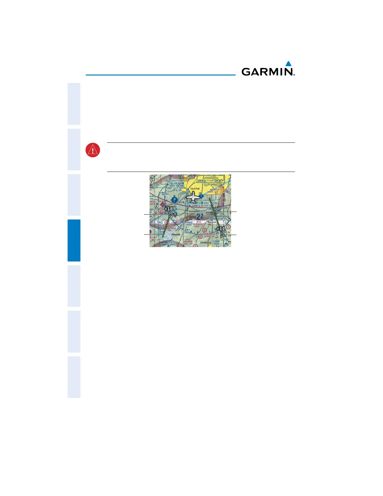
In addition to the Traffic Page, the Map Page can show TargetTrend vectors of nearby
traffic. These indications are overlaid on top of regular topographic maps and VFR/IFR
charts, showing how nearby traffic relates to surrounding waypoints, airspaces and
ground features.
WARNING: The TargetTrend vectors shown on the Map Page represent
relative motion in relation to the aircraft, not absolute motion in relation
to the ground.
TargetTrend Overlaid on Moving Map
TargetTrend
Motion Vector
TargetTrend
Motion Vector
Traffic Direction
and Relative
Altitude
Traffic Direction
with Relative
Altitude and
Altitude Trend
Enabling/Disabling TargetTrend Overlay:
1)
With the Map Page displayed, touch Menu > Set Up > Traffic.
2)
Touch On or Off.

 Loading...


