Garmin aera 660 Pilot’s Guide
190-02017-20 Rev. E
55
Navigation
Overview Navigation Flight Planning Hazard Avoidance Additional Features Appendices Index
a)
Touch Find.
b)
Touch the Recent, Nearest Airports, Flight Plan, or User Tab.
c)
Touch the desired waypoint from the list.
4)
If duplicate entries exist for the entered facility name or location, duplicate
waypoints are displayed. Touch the desired waypoint from the list.
5)
If multiple runways exist, touch the Runway Button, and touch the desired
runway from the vertical list.
Option
Menu
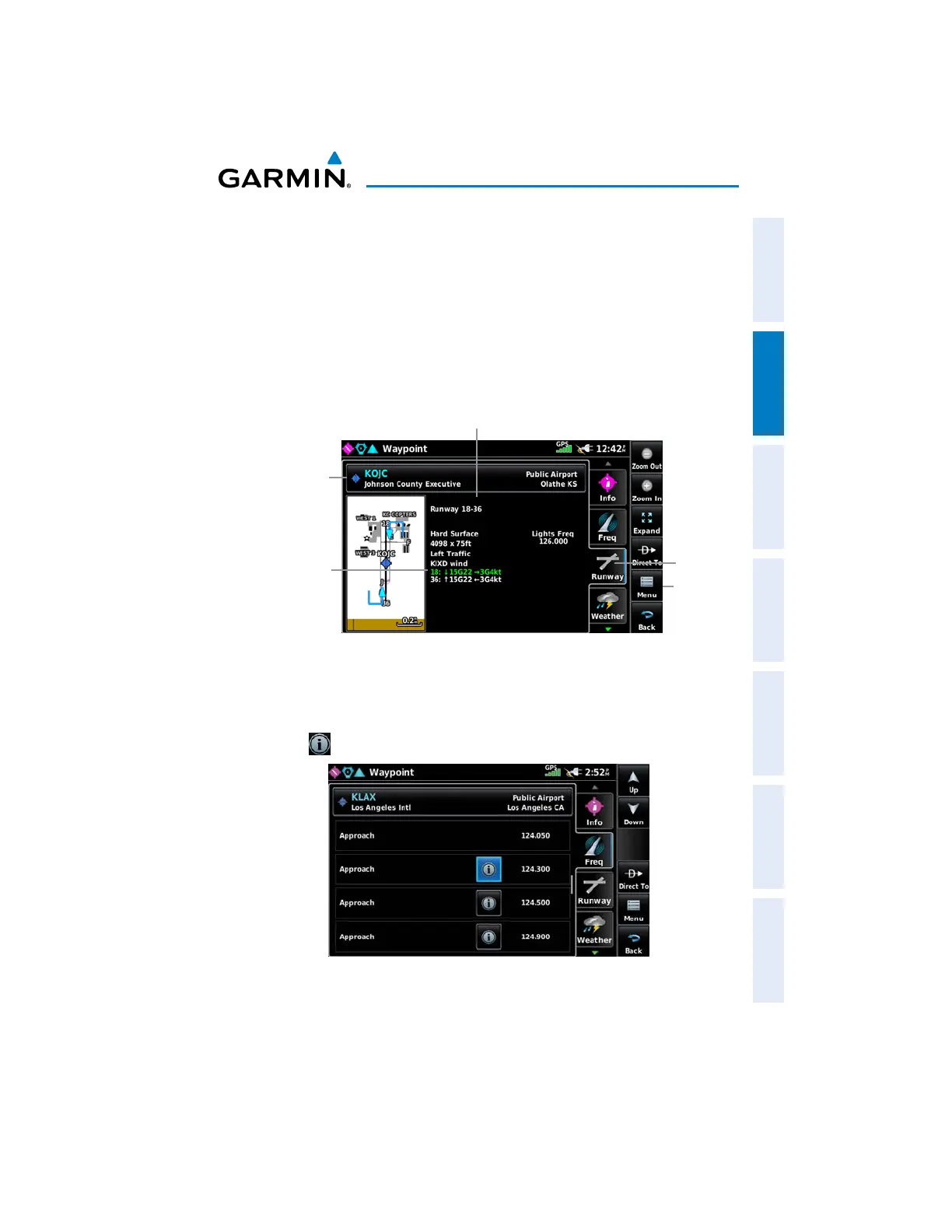
Runway Tab
Waypoint Information (Runway Tab)
Waypoint
Identifier
Button
-Length/Width
-Surface
-Lighting
-Traffic Pattern
Wind vectors are
displayed as headwind
and crosswind com-
ponents. The runway
with the best headwind
is displayed in green.
Selecting additional information for a frequency:
1)
From the Main Menu, touch Waypoint > Freq Tab (if necessary).
2)
Touch .
Waypoint Information (Freq Tab)

 Loading...


