Title Viewing Trip Gauges
Identifier GUID-D6BC3B29-5363-4562-921F-EA5C3F0A9A8E
Language HR-HR
Description
Version 1
Revision 3
Changes
Status Released
Last Modified 19/08/2014 11:25:25
Author gristk
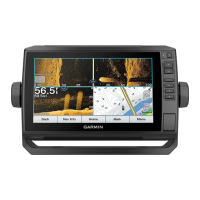
Pregled mjerača puta
Mjerači puta prikazuju informacije za odometar, brzinu, vrijeme i gorivo vašeg trenutnog puta.
Odaberite Mjerači > Put.
Title Resetting Trip Gauges
Identifier GUID-FF297225-C214-4CFE-AFC6-EB0A107D827F
Language HR-HR
Description
Version 5
Revision 2
Changes ECHOMAPs old adding Menu
Status Released
Last Modified 21/06/2022 11:57:29
Author gristk
Ponovno postavljanje mjerača puta
1 Odaberite Mjerači > Put > Izbornik.
2 Odaberite opciju:
• Za postavljanje očitanja trenutnog puta na nulu odaberite Ponovo postavi put.
• Za postavljanje očitanja maksimalne brzine na nulu odaberite Ponovo postavi maksimalnu brzinu.
• Za postavljanje očitanja brojača kilometara na nulu odaberite Ponovno postavi brojač kilometara.
• Za postavljanje svih očitanja na nulu odaberite Ponovo postavi sve.
Mjerači i grafikoni 167
 Loading...