Do you have a question about the Garmin GPSMAP 4210 and is the answer not in the manual?
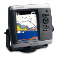
Details the physical components, ports, and basic layout of the GPSMAP 4000 series units.
Instructions on how to turn the unit on/off, adjust backlight, and change color modes.
Guides on SD card usage, restoring factory settings, viewing system info, and simulator mode.
Explains how to navigate through menus and access various functions from the Home screen.
Guidance on searching for and navigating to various points of interest or locations.
Instructions for marking, editing, and managing waypoints on the chart.
Steps for planning, creating, and editing navigation routes.
General unit configuration options including language and simulator mode.
Setting measurement units and configuring communication ports.
Setting various audible alarms for navigation and system events.
Configuring system, sonar, weather alarms, and boat parameters.
Customizing boat parameters, keel offset, and settings for other boats.
Configuring XM audio features and customizing safe zone parameters.
Adjusting sonar range, gain, frequency, and zoom for optimal performance.
| Display Size | 10.4 inches |
|---|---|
| Resolution | 800 x 600 pixels |
| Waterproof Rating | IPX7 |
| Map Data | BlueChart g2 |
| Voltage Range | 10-35 VDC |
| Antenna | Internal |
| Preloaded Maps | Yes |
| NMEA Input/Output | Yes |
| Built-in charts | Yes |
| Chartplotter | Yes |
| Sonar capable | Yes |
| Radar capable | Yes |
| NMEA 2000 compatible | Yes |
| Receiver | High-sensitivity GPS |
| Memory Card Slot | SD card slot |