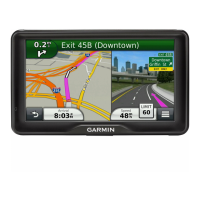
Navigation settings
Select > Navigation.
Calculation Mode: sets the route calculation method.
Avoidances: sets road features to avoid on a route.
Custom Avoidances: allows you to avoid specific roads or areas.
Environmental Zones: sets the avoidance preferences for areas with environmental or emissions restrictions
that may apply to your vehicle.
Restricted Mode: disables all functions that require significant operator attention.
GPS Simulator: stops the device from receiving a GPS signal and saves battery power.
Setting a simulated location
If you are indoors or not receiving satellite signals, you can use the GPS simulator to plan routes from a
simulated location.
1 Select > Navigation > GPS Simulator.
2 From the main menu, select View Map.
3 Tap the map twice to select an area.
The address of the location appears at the bottom of the screen.
4 Select the location description.
5 Select Set Location.
Wireless network settings
The wireless network settings allow you to manage Wi‑Fi networks, paired Bluetooth devices and Bluetooth
features.
Select > Wireless Networks.
Bluetooth: enables Bluetooth wireless technology.
Paired Device Name: the names of paired Bluetooth devices appear in the menu. You can select a device name
to change Bluetooth feature settings for that device.
Search for Devices: searches for nearby Bluetooth devices.
Friendly Name: allows you to enter a friendly name that identifies your device on other devices with Bluetooth
wireless technology.
Wi-Fi: enables the Wi‑Fi technology.
Saved Networks: allows you to edit or remove saved networks.
Search for Networks: searches for nearby Wi‑Fi networks (Connecting to a Wi‑Fi Network, page 57).
Driver Assistance Settings
Select > Driver Assistance.
Driver Alerts: allows you to enable or disable alerts for upcoming zones or road conditions (Driver awareness
features and alerts, page 14).
Speeding Alert: alerts you when you are exceeding the speed limit.
Reduced Speed Tone: alerts you when the speed limit decreases.
Route Preview: displays a preview of the major roads on your route when you start navigation.
Proximity Alerts: alerts you when you approach speed cameras or red light cameras.
Plan Arrival: displays a map of your destination at the end of a route. You can also enable your device to
download satellite imagery using the mobile data on your paired smartphone.
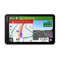
Forward collision warning: allows you to enable and set the sensitivity of the forward collision warning. A higher
sensitivity alerts you sooner than a lower sensitivity.
Lane Departure Warning: enables the device to alert you when it detects you may be crossing a lane boundary
unintentionally.
Settings 53
 Loading...