18 c510 Owner’s Manual
cUStoMiSinG the c510
cUStoMiSinG the c510
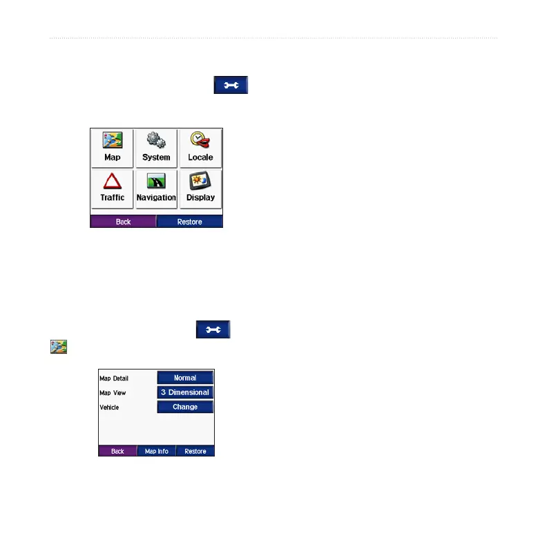
1. From the Menu page, touch .
2. Touch the setting you want to change.
3. Touch the button next to the setting
name to change it.
Changing the Map
Settings
From the Menu page, touch >
Map.
Map Detail—adjust the amount of detail
shown on the map. Showing more detail
may cause the map to redraw slower.
Map View
—change the perspective of
the map.
Track Up
—display the map in 2
dimensions (2D) with your direction
of travel at the top.
North Up
—display the map in 2D
with North at the top.
3D—display the map in 3 dimensions
(3D) in Track Up.
Vehicle
—touch Change to change the
icon used to display your position on
the map. Touch the icon you want to
use, and then touch OK. Download
additional vehicle icons at www.garmin
.com/vehicles.
Map Info
—view the maps loaded on
your c510 and their version. Touch a
map to enable (check mark) or disable
(no check mark) that map.
Restore
—restore the original map
settings.
•
•
•
 Loading...