38EZiSYSTEM, How to Use the Locator
2.8 Internal GPS
Data Records The i700, i750, i750xf locators have an internal GPS module which is used to record the
geographical position of use. The geographical position (Latitude and Longitude) is stored
in the log file and provides information on where the locator was used.
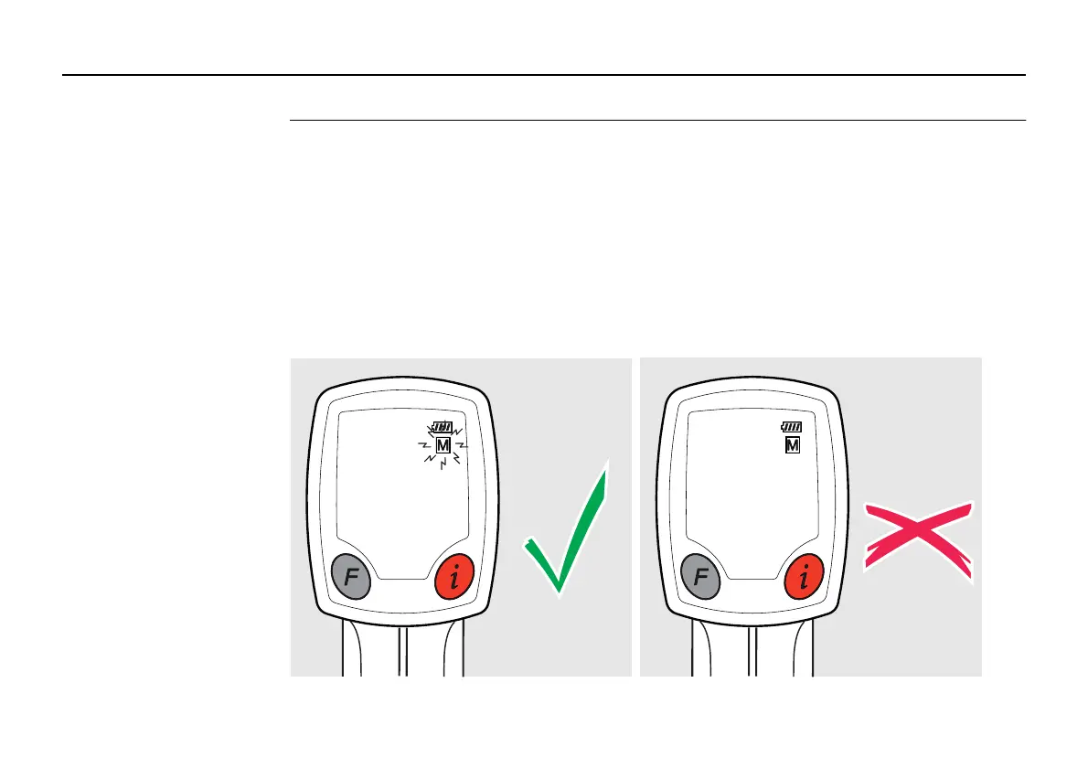
The M icon is used to display the GPS status as follows:
M flashing: GPS fix available and the geographical position is being recorded to the loca-
tors log files.
M static: No GPS fix and the geographical position is not being recorded to the locators log
files
 Loading...