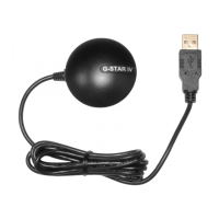
EB-3531
Specifications are subject to be changed without notice.
Page 16 of 21
Version 1.2.1
Satellites in View 07
Satellite ID 07 Channel 1(Range 1 to 32)
Elevation 79 degrees Channel 1(Maximum90)
Azimuth 048 degrees Channel 1(True, Range 0 to 3
SNR(C/No) 42 dBHz Range 0 to 99,null when not tr
……. …….
Satellite ID 27 Channel 4 (Range 1 to 32)
Elevation 27 Degrees Channel 4(Maximum90)
Azimuth 138 Degrees Channel 4(True, Range 0 to 3
SNR(C/No) 42 dBHz Range 0 to 99,null when not tr
Checksum *71
<CR><LF> End of message termination
Depending on the number of satellites tracked multiple messages of GSV data may be required.
RMC-Recommended Minimum Specific GNSS Data
Table B-9 contains the values for the following example:
$GPRMC,161229.487,A,3723.2475,N,12158.3416,W,0.13,309.62,120598,,*10
Table B-9 RMC Data Format
Name Example Units Description
Message ID $GPRMC RMC protocol header
UTC Time 161229.487 hhmmss.sss
Status A A=data valid or V=data not valid
Latitude 3723.2475 ddmm.mmmm
N/S Indicator N N=north or S=south
Longitude 12158.3416 dddmm.mmmm
E/W Indicator W E=east or W=west
Speed Over Ground 0.13 knots
Course Over Ground 309.62 degrees True
Date 120598 ddmmyy
Magnetic Variation
2
degrees E=east or W=west
Checksum *10
<CR><LF> End of message termination
SiRF Technology Inc. does not support magnetic declination. All “course over ground” data are
Geodetic WGS48 directions.
VTG-Course Over Ground and Ground Speed
$GPVTG,309.62,T,,M,0.13,N,0.2,K*6E
Table B-9 VTG Data Format
Name Example Units Description
Message ID $GPVTG VTG protocol header