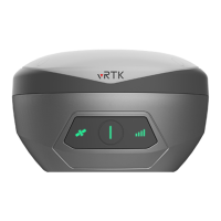
vRTK GNSS System User Manual
31
3.1 Technical Parameters
Table 3-1-1 Technical Parameters
Satellite signals
tracked
simultaneously
[1]
BDS: B1I,B2I,B3I,B1C,B2a,B2b*
GPS: L1C/A,L1C,L2P(Y),L2C,L5
ASCII: NMEA-0183, Binary data
VRS,FKP,MAC,support NTRIP protocol
8G internal storage,supports automatic cyclic storage of static data
Accuracy and
reliability
[2]
Horizontal: ± (8+1×10
-6
D) mm
(D is the distance between measurement points)
Vertical: ± (15+1×10
-6
D) mm
(D is the distance between measurement points)
Static
measurement
precision
Horizontal: ± (2.5+0.5×10
-6
D) mm
(D is the distance between measurement points)
Vertical: ± (5+0.5×10
-6
D) mm
(D is the distance between measurement points)
less than 8mm+0.7mm/
°
tilt(2.5cm accuracy in the inclination of 60
°
)