Do you have a question about the Leica Wild tc1610 and is the answer not in the manual?
Describes using a GPH1A prism holder with a WILD Distomat for distance measurement.
Describes using a GPH1 prism holder with target plate GZT4.
Details measurement procedures using specific functions and parameters.
Explains inputting parameters to compute coordinates and setting display masks.
Explains determining and storing vertical-index error for improved accuracy.
Describes the REC module for data recording, capacity, and file usage.
Details defining measurement masks and line elements for recording.
Allows input of station/target coordinates and REM/EDM correction values.
Manages recording parameters and setting/defining recording masks.
Manages system parameters, loading and deleting programs.
Enables separate distance/angle measurement and recording.
Instructions for charging the theodolite's battery using GKL12 charger.
Explains adjusting the instrument for collimation error using a target.
Explains computing scale correction based on atmospheric pressure and temperature.
Explains reducing distances to mean sea level using formulas.
Explains computing correction based on projection line and scale factor.
Describes starting programs directly or via configuration menu.
Details program flow, input, measurement, and result display.
| Brand | Leica |
|---|---|
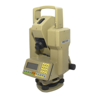
| Model | Wild tc1610 |
| Category | Laser Level |
| Language | English |