18
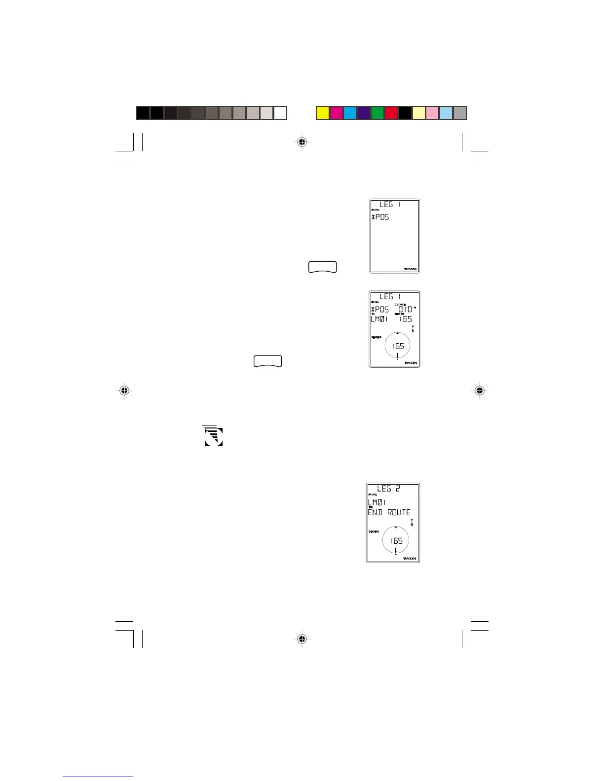
The receiver prompts you for a starting
landmark for the route. The first landmark,
*POS, is your present position. Use the
ARROW pad to scroll through the list of
landmarks. When the desired landmark is
displayed (and flashing) press
.
The display changes to allow the selection of
the landmark to be used as the end of the
first leg in the route. Use the ARROW pad
to scroll through the list of landmarks.
When the desired landmark is displayed (and
flashing) press
ENTER
. Note that as you
scroll through the list of landmarks, the
display updates showing you the bearing and distance from
the start of this leg to the displayed landmark.
If the distance from the start of the leg to the end of
the leg is below 0.10 miles, the message INVALID is
displayed and you are prompted to select a different
landmark.
The screen changes to the next leg in the
route with the destination landmark of the
previous leg inserted as the start of the next
leg. The message END ROUTE is
displayed in the TO field. You may
continue this route by using the ARROW