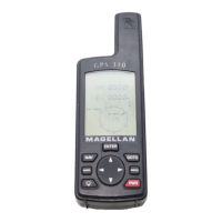
Do you have a question about the Magellan 310 and is the answer not in the manual?
Advises on safe operation, user judgment, and proper accessory use for the GPS device.
Details warranty period, remedy options, buyer duties, and limitations on implied warranties.
Explains the manual's layout and provides guides for initial device setup and basic operation.
Covers power, backlight, contrast controls, and detailed map screen features.
Details various navigation displays and procedures for creating GOTO routes.
Guides on initialization, route management, and screen customization.
Covers coordinate systems, time settings, units, alarms, and data output.
Addresses common user questions on device operation, waypoints, navigation, and routes.
Provides solutions for common problems like power, position fix, and unexpected shutdowns.
References waypoint icons, support contact, technical specifications, and available accessories.
Instructions for connecting external devices and an overview of WAAS technology.
Definitions for terms like Active Leg, Altitude, BRG, COG, Coordinates, CTS, Datum, DST, ETA.
Definitions for ETE, HDG, Latitude, LAT/LON, Leg, Longitude, Magnetic North, NMEA, OSGB, Position Fix, SOG, TMP.
Definitions for True North, UTC, UTM, VMG, WPT, and XTE.
| Waypoints | 500 |
|---|---|
| Routes | 20 |
| Bluetooth | No |
| Wi-Fi | No |
| Touchscreen | No |
| Voice Navigation | No |
| Supported Satellite Systems | GPS |
| Position Accuracy | 3 meters |
| Battery Type | 2 AA batteries |
| Waterproof | IPX7 |
| Geocache Support | Yes |
| SBAS/WAAS/EGNOS | WAAS/EGNOS enabled |
| Preloaded Maps | No |
| Receiver | High-sensitivity GPS |