5
ENTER ELEVATION. Use the ARROW pad to enter
the approximate elevation for your position. If unknown,
leave the elevation at 0. Press
ENTER TIME. Use the ARROW pad to enter your
present time. Press
ENTER
ENTER DATE. Use the ARROW pad to enter the date.
Press
ENTER
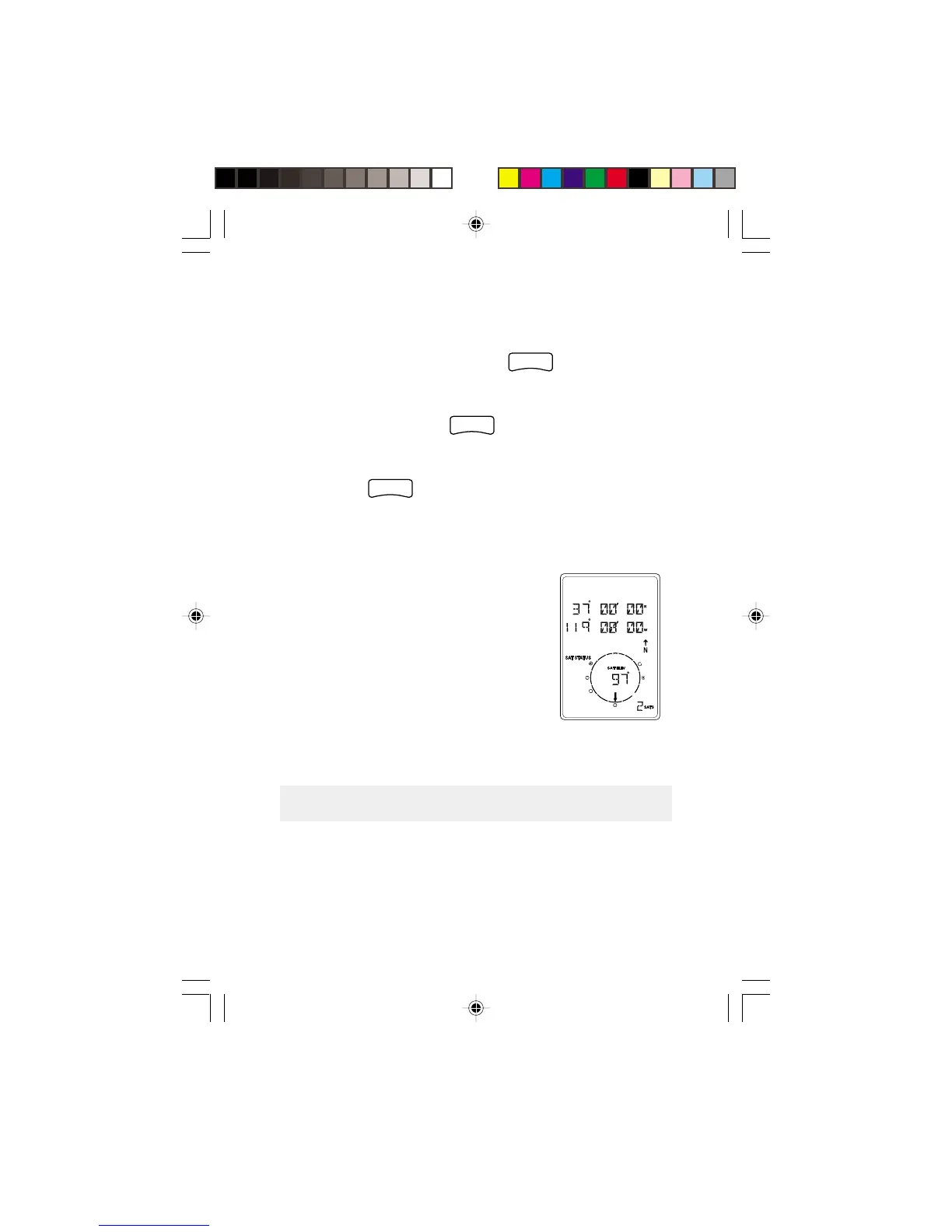
The GPS 310 then displays the POSITION screen and
automatically begins searching for satellites that it knows are
in this area for the date and time
you entered.
The display shown here may differ
from yours depending upon the
information you selected in steps 2
and 3. As the GPS 310 scans the
sky, the arrow in the circle will swing
around pointing to a satellite and
displays, in the center of the circle,
that satellite’s elevation above the horizon.
Computing a Position
The GPS 310 will begin to acquire information from the
satellites and use this information to compute your current
position (called a position fix). Whether you have just