Do you have a question about the NorthStar EXPLORER 657 and is the answer not in the manual?
Covers product liability, governing language, and FCC statement.
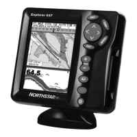
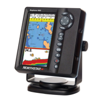
Introduces the compact, rugged chartplotter and fishfinder.
Provides instructions for cleaning the display and transducers.
Explains the two types of plug-in cards: C-MAP chart and C-MAP user cards.
Details how to safely remove and replace the display unit from its bracket.
Describes the function of each key on the device.
Explains how to use keys for navigation and selection.
Details manual power control and automatic power features.
Covers adjusting display brightness and activating night mode.
Explains how to use the MOB feature to save and navigate to a position.
Describes how the unit handles alarm conditions and sounds.
Guides on using simulate mode for familiarization off the water.
Introduces accessing main display windows like Chart and Sonar.
Explains how to display two windows simultaneously.
Details setting up and selecting commonly used display combinations.
Covers displaying data at the top of windows.
Explains how to display a compass on chart, sonar, or highway screens.
Explains the two main navigation methods: going to a point or following a route.
Details how to navigate to a specific waypoint or chart position.
Guides on selecting and navigating to waypoints from chart or waypoint lists.
Describes creating, starting, and navigating along a defined route.
Explains the layout and components of the chart display.
Details the center-on-boat and cursor modes for chart viewing.
Explains how to zoom in and out on the chart.
Guides on searching for and displaying chart symbols.
Explains how to calculate distances and bearings between points.
Covers displaying projected boat position based on speed and heading.
Details recording and displaying the boat's course history.
Describes the list of entered waypoints and their details.
Covers creating, moving, editing, displaying, and deleting waypoints.
Lists all entered routes with their start, end, and distance.
Details creating, editing, displaying, and deleting routes.
Explains the GPS system and its accuracy.
Describes Differential GPS and its types (WAAS/EGNOS, Beacon).
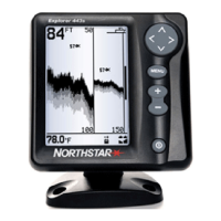
Explains how the sonar transducer works and converts echoes.
Guides on understanding sonar display history and echo strength.
Details using 200 kHz, 50 kHz, and mixed frequencies for fishfinding.
Explains finding fish, fish symbols, and fish arches.
Covers adjusting the sonar display's depth range (Auto/Manual).
Details controlling display detail with gain and threshold settings.
Describes the basic sonar history display.
Explains using zoom features to magnify sonar history sections.
Shows sonar history with a zoomed bottom signal.
Displays sonar history using both 50 kHz and 200 kHz frequencies.
Combines sonar history with an A-Scope for echo strength analysis.
Guides on choosing a display layout for analog gauges.
Explains how to customize the data shown on each gauge.
Details how to choose the numeric data fields to display.
Explains how the fuel computer estimates fuel remaining, range, and economy.
Describes the information displayed in the fuel window.
Guides on accurately informing the 657 about fuel level changes.
Details how to set up a low fuel alarm for tanks.
Explains selecting speed sources (GPS, paddlewheel, pitot).
Compares water speed vs. ground speed and their impact.
Details creating and using fuel consumption curves for performance optimization.
Guides on calibrating fuel flow sensors for accuracy.
Explains how to select the date for tide information.
Displays files (waypoints, routes, tracks) stored on the user card.
Details how to save 657 data onto a user card.
Explains how to load data from a user card to the 657.
Describes how to view AIS vessel information on the chart.
Explains how the 657 identifies and displays dangerous vessels.
Covers accessing AIS vessel lists and safety messages.
Describes the Distress, Poll, and Buddy track display types.
Explains how distress messages are received and displayed.
Guides on displaying, going to, and managing boats on the chart.
Covers language, backlight, key beep, and factory reset options.
Details chart rotation, palette, map datum, and other chart settings.
Covers sonar frequency, scroll speed, fish settings, and filters.
Details GPS source, DGPS, static navigation, and filters.
Covers fuel sensor settings, engines, tanks, and curves.
Details track recording, display, and plotting intervals.
Covers AIS filtering, dangerous vessel alarms, TCPA, and CPA limits.
Details resetting trip distance, total distance, and engine hours.
Explains how to enable and configure various alarms.
Covers setting units for distance, speed, depth, fuel, and compass.
Details NMEA and NavBus communication settings.
Guides on calibrating speed, temperature, and keel offset.
Covers setting local time offset, time format, and date format.
Details how to set up favorite display configurations.
Explains how to configure simulate mode for practice.
Lists the components included in the 657 package.
Describes optional sensors and accessories for the 657.
Provides guidance on selecting a mounting position and method.
Details wiring the power/data cable for basic or auto power.
Explains selecting and installing GPS antennas.
Provides instructions for installing sonar transducers.
Details the installation of optional fuel flow sensors.
Explains connecting the 657 to SmartCraft™ engines.
Covers connecting other Northstar instruments via NavBus.
Details connecting compatible instruments via NMEA.
Guides on initial setup and testing the installed system.
Addresses common issues like unit not turning on or off.
Troubleshoots issues with GPS fix, position accuracy, and chart matching.
Addresses inaccurate fuel readings and flow issues.
Troubleshoots erratic sonar operation and display issues.
Defines common terms used in marine navigation and the manual.
Explains navigation parameters like BRG, COG, CTS, ETA, SOG, XTE, VMG.
| Brand | NorthStar |
|---|---|
| Model | EXPLORER 657 |
| Category | Fish Finder |
| Language | English |