Do you have a question about the NorthStar Explorer 660 and is the answer not in the manual?
Guidance on cleaning the display screen and transducers to prevent damage and ensure optimal performance.
Details on using C-MAP chart and user cards for navigation data storage, transfer, and chart details.
Instructions for safely detaching and reattaching the display unit from its mounting bracket for security or protection.
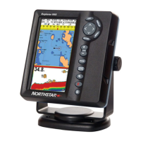
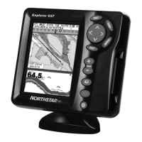
Explanation of the function of each key on the Explorer 660 control panel for efficient operation.
Procedures for powering the unit on and off manually or via auto power wiring for convenient use.
Instructions for adjusting the display and key backlighting levels for optimal visibility in various lighting conditions.
How to activate the Man Overboard feature to save position and navigate back to a person overboard.
Information about the Explorer 660's audible and visual alarm system for various navigation and system conditions.
Guidance on using simulation modes to practice operations without affecting real-time data or vessel status.
Overview of how to access and switch between the primary display modes like Chart, Sonar, and Others for data viewing.
How to view two different displays simultaneously and manage the active display for multitasking.
Instructions for selecting and switching between commonly used favorite displays using the PAGES key.
How to configure and display data headers and the compass on various screen modes for enhanced situational awareness.
Overview of navigation methods: going straight to a point or following a defined route.
Detailed explanation of the chart display elements and how to interpret them, including modes and symbols.
How to use the calculator to plot courses, measure distances, and calculate bearings between points.
Using the GOTO/AUTO key to initiate navigation to waypoints or routes, and how to cancel the process.
How to display projected position based on speed, course, and time for advanced route planning.
Recording and displaying the boat's course history on the chart at set time or distance intervals.
How to view the list of entered waypoints, including their details, icons, and display options.
Core functions for creating, editing, moving, and deleting waypoints from the system.
Starting and cancelling navigation to a selected waypoint, ensuring safe course plotting.
Viewing the list of created routes with their names, start/end points, number of legs, and total distance.
Steps for creating, editing, and displaying routes on the chart for planning and safety checks.
How to start, skip waypoints within, and cancel navigation along a defined route for efficient travel.
Explanation of the Global Positioning System (GPS) operation and its satellite-based navigation principles.
Details on Differential GPS systems (WAAS/EGNOS, beacon) for improving position accuracy.
Requirements for using external GPS antennas and configuring different antenna options for optimal reception.
Information on the initial startup sequence and time required for the GPS receiver to acquire a fix.
How to view satellite status, signal strength, HDOP, and GPS position information on the display.
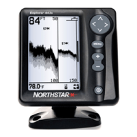
Basic principles of sonar operation, echo reflection, pulse transmission, and display scrolling mechanics.
Guidance on understanding sonar echoes, their color strength, fish symbols, and bottom types for effective fishing.
When to use 50 kHz, 200 kHz, or mixed frequencies for optimal sonar performance in different water conditions.
Techniques for finding fish, interpreting fish symbols, understanding fish arches, and dealing with noise.
How to adjust gain, threshold, and range settings for optimal sonar performance and clarity.
Description of the standard sonar history display showing echoes over time without splitting the screen.
How to use the zoom function to magnify specific sections of the sonar display for detailed analysis.
Using the bottom display mode to analyze bottom signals, types, and identify objects close to the seabed.
Viewing simultaneous 50 kHz and 200 kHz sonar history on a split screen for comparative analysis.
Utilizing the A-scope display for real-time echo analysis and manual adjustment of gain and threshold settings.
Steps to select the desired date for viewing tide station information and tide height data.
Configuring system settings like language, backlight, key beep, auto power off, and factory reset options.
Customizing chart display settings such as rotation, CDI scale, plotter mode, mixing levels, palette, and compass.
Adjusting sonar parameters like frequency, scroll speed, fish symbols, filter, digit size, depth line, and display elements.
Configuring GPS source, DGPS, static navigation, and speed/course filters for accurate positioning and navigation.
Setting up and calibrating fuel monitoring features, including engine count, tank size, and flow filters.
Managing track recording settings, display options, plotting intervals, and deleting tracks.
Resetting trip distance, total distance, and engine hours logs for accurate record keeping.
Configuring various audible and visual alarms for navigation, safety, and system status conditions.
Setting preferred units for distance, speed, depth, fuel, compass, temperature, and wind for display.
Configuring communication settings for NMEA and NavBus connections to other instruments and data sharing.
Calibrating speed, temperature, fuel sensors, and keel offset for accurate measurements and readings.
Setting local time offset, time format (12/24 hour), and date format for accurate timekeeping.
Configuring favorite display presets accessible via the PAGES key for quick access to frequently used screens.
Using simulation modes to practice operations with simulated speed, heading, or routes without affecting live data.
List of items included in the Explorer 660 package, ensuring all components are accounted for.
Details on optional accessories and compatible add-ons that enhance the functionality of the Explorer 660.
Instructions for flush or bracket mounting the display unit securely and optimally for viewing and operation.
Guidance on installing the GPS antenna, sonar transducer, and optional fuel kit for proper system function.
Step-by-step instructions for wiring the power/data cable for basic or auto power operation.
Connecting the Explorer 660 to other instruments via NavBus or NMEA for data sharing and integrated system operation.
Troubleshooting common issues related to power, display, basic operation, and general unit behavior.
Solutions for GPS fix issues, position inaccuracies, chart display problems, and autopilot communication errors.
Diagnosing and resolving issues with sonar operation, bottom detection, signal quality, and transducer performance.
Troubleshooting inaccurate fuel readings, flow issues, economy calculations, and sensor connection problems.
| Display Type | Color LCD |
|---|---|
| GPS | Yes |
| Transducer | Included |
| Waterproof Rating | IPX7 |
| Sonar Frequency | 200 kHz |