EasyManua.ls Logo

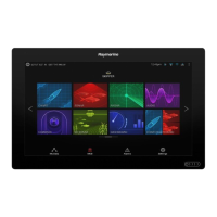
Raymarine a77 User Manual

Raymarine a77
388 pages
To Next Page IconTo Next Page
Page #1 background imageLoading...
Page #1 background image
LightHouse™
OPERATION
INSTRUCTIONS
Release 15
English
© 2015 Raymarine UK Limited
Date: 09-2015
Document number: 81360-2-EN

Table of Contents

Other manuals for Raymarine a77

Questions and Answers:

Raymarine a77 Specifications

General IconGeneral
Display Size7 inches
Display Resolution800 x 480 pixels
ChartplotterYes
EthernetYes
Operating Temperature-15°C to +55°C
GPSBuilt-in GPS
Wi-FiYes
Waterproof RatingIPX6
CartographyNavionics
Radar CompatibilityRaymarine Quantum and HD Radar
Sonar CompatibilityCHIRP
NetworkingNMEA 2000, NMEA 0183

Summary

Important Information

Certified Installation

Recommends certified installation by an approved installer for enhanced warranty benefits.

Disclaimers

Details regarding product usage, chart data, and compatibility with third-party products.

Memory cards and chart cards

Information on using MicroSD cards for data backup, archiving, and chart data.

EMC installation guidelines

Explains Electromagnetic Compatibility (EMC) regulations and installation requirements.

Document and product information

Handbook information

Overview of the handbook's applicability, scope, and software revision details.

Product overview

Details the various display variants for a Series, c Series, and e Series MFDs.

Planning the installation

System integration

Details device compatibility and connection protocols within the system.

Installation checklist

Lists the essential activities involved in installing the system.

Multiple data sources (MDS) overview

Explains how MDS manages data conflicts and allows selection of preferred data sources.

Networking constraints

Details general, master/repeater, homescreen, cartography, radar, and sonar networking constraints.

System protocols

Explains how the display connects using various protocols like SeaTalkhs, SeaTalkng, NMEA 2000, SeaTalk, and NMEA 0183.

Selecting a location

Provides guidance on selecting an optimal mounting location considering ventilation, surface, cabling, and interference.

Cables and connections

General cabling guidance

Provides guidance on cable types, routing, strain relief, circuit isolation, and cable shielding.

Connections overview

Details available connections for various Raymarine MFDs across different models.

Power connection — a6x and a7x

Explains power connection requirements, distribution, grounding, and warnings for a6x and a7x models.

Network connections

Explains connecting compatible devices using Network connectors and lists typical network devices.

Radar connection

Explains how to connect HD/SuperHD radar scanners directly or via a network switch.

Thermal camera connection

Explains how to connect thermal cameras to compatible displays via network switch or composite video.

IP Camera connections

Covers connecting IP cameras, configuration requirements, and guidance for third-party cameras.

Fusion link connection

Details how to connect a Fusion 700 series entertainment system to the multifunction display.

AIS connection

Explains how to connect compatible AIS units using SeaTalkng or NMEA 0183.

SeaTalkng connections

Explains connecting to a SeaTalkng network for instruments, autopilots, and NMEA 2000 equipment.

NMEA 0183 connection

Details connecting NMEA 0183 devices using the power and data cable, including port configuration.

Mounting

Mounting - a Series

Provides instructions for surface and bracket mounting of a Series displays.

Mounting - c Series and e Series

Details procedures for surface mounting and bracket mounting of c Series and e Series displays.

Getting started

Initial set up procedures

Guides through the startup wizard for essential configuration settings like language, boat details, and units.

GPS Status

Explains how to view and interpret GPS status, satellite information, and position data.

Enabling autopilot control

Details steps to enable autopilot control for SeaTalk, SPX, and Evolution autopilots.

Software updates

Provides instructions on how to download and install software updates to enhance features and performance.

System checks

GPS Check

Guides on checking GPS operation using the chart application and verifying vessel position.

Radar check

Provides steps for checking radar operation, including safety precautions and bearing alignment.

Sonar check

Details selecting sonar channels, transducers, and performing calibration checks.

Managing display data

Saving user data and user settings

Explains how to save waypoints, routes, tracks, and settings to a memory card.

Resetting your system

Explains how to reset the system to factory defaults, including settings and data reset.

Customizing your display

Boat details

Explains how to customize settings like boat type, engine count, and fuel capacity for the vessel.

Display preferences

Covers settings for general display behavior like startup page, key beep, cursor autohide, and range controls.

Databar and databox overview

Explains how to customize displayed data in the databar and databoxes, including auto-hide functionality.

Document viewer application

Document viewer overview

Explains how to view and search PDF documents, including user manuals and license agreements.

Autopilot control

Enabling autopilot control

Details steps to enable autopilot control for SeaTalk, SPX, and Evolution autopilots.

Disengaging the autopilot

Details methods to disengage the autopilot using power button, shortcuts, pilot button, or chart application.

Pilot Control dialog

Describes the Pilot Control dialog options for standby, auto, and starting navigation modes.

Pilot Set-up

Details the Pilot Set-up page for Evolution autopilots, including vessel settings and commissioning.

Alarm management

Alarms overview

Explains how alarms alert users to hazards and the color coding for severity.

Alarm Manager overview

Details how to configure alarm behavior, adjust thresholds, and view alarm history.

Alarm options

Lists available safety alarms like Waypoint arrival, Off track, Safezone, Anchor alarm, Low fuel, DSC, AIS, and MOB.

Man Overboard (MOB)

Man overboard

Explains the MOB function for marking a position and its activation/cancellation procedures.

DSC VHF radio integration

DSC VHF radio integration

Describes connecting DSC VHF radio to the MFD for distress message info and GPS position.

Enabling DSC VHF radio integration

Details how to enable DSC Alerts from the System Settings menu.

Fuel manager

Fuel manager overview

Explains the fuel manager's function for estimating fuel remaining, distance, and time, and setting low fuel warnings.

AIS function

AIS overview

Explains how AIS enables receiving broadcast information from other vessels and displaying them as targets.

Enabling AIS

Guides on enabling AIS overlay in Chart and Radar applications.

Using AIS to avoid collisions

Details the use of AIS safe zones and safety messages to prevent collisions.

Buddy tracking

Covers adding AIS-equipped friends to a Buddy List for tracking and identification.

Waypoints, Routes and Tracks

Waypoints overview

Explains waypoints as position markers for navigation, accessed via menus and context menus.

Routes

Describes routes as series of waypoints for passage planning and navigation.

Tracks

Explains tracks as on-screen trails showing passage, created automatically from track points.

Import and Export

Details how waypoints, routes, and tracks can be imported and exported using a memory card.

Chart application

Chart application overview and features

Provides an overview of the chart application's features for route planning and navigation.

Electronic charts overview

Explains the use of world base maps and electronic charts for detailed cartographic information.

Navigation options

Details navigation features like Pilot Controls, Goto Cursor, Goto Waypoint, and Follow Route.

Chart motion mode

Explains how motion mode controls the relationship between the chart and vessel, including Relative and True Motion.

Overlays

Describes chart overlays like AIS, Radar, Aerial, NOWRad, Databoxes, and Chart Grid for enhanced information.

Cartography objects

Details how to switch cartographic objects and overlays like Show Rocks, Nav. Marks, and Routing Systems on/off.

Object information

Explains how to view detailed information about specific cartographic objects using Chart Objects or Find Nearest.

Depth & Contour options

Details depth and contour settings available based on cartography type, including Show Soundings and contours.

Fishfinder application

Fishfinder overview and features

Provides an overview of the Fishfinder application, sonar technologies, and features.

Sonar technologies

Explains Traditional, CHIRP, DownVision, and SideVision sonar technologies and their characteristics.

Sonar crosstalk interference

Discusses potential sonar crosstalk interference and methods for reducing it.

Sensitivity settings

Provides access to features and functions that enhances what is displayed on-screen.

Fishfinder alarms

Details Fishfinder alarms for depth data, including Fish, Fishfinder Deep, and Fishfinder Shallow alarms.

Resetting the sonar

Explains how to reset the sonar unit to factory default values, clearing calibration settings.

Data application

Data application overview

Explains how the Data application enables viewing system and instrument data, with pre-configured datapages.

Customizing the data application

Covers customizing datapage order, content, renaming, adding, deleting, and resetting pages.

Engine identification

Explains how to display and identify engine data using the Data application and engine identification wizard.

Units set-up

Guides on specifying preferred units of measurement for distance, speed, depth, etc.

Radar application

Radar application overview and features

Provides an overview of the Radar application, its features, and how radar works.

Radar range and image quality

Discusses factors affecting radar image quality, including side lobes, indirect echoes, and clutter.

Target tracking

Explains Guard Zone, VRM/EBL, and MARPA functions for tracking targets and avoiding collisions.

Radar mode and orientation

Explains radar orientation modes (Head-Up, North-Up, Course-Up) and motion modes (Relative, True).

Radar tuning: On-screen gain controls

Explains how to use on-screen controls for Gain, Rain, and Sea clutter tuning.

HD and SuperHD radar adjustments

Covers adjustments for HD and SuperHD radar scanners, including presets, rain, and adjust controls.

Dual range radar operation

Explains the Dual range radar function for viewing two ranges simultaneously.

Resetting the radar

Provides steps to reset radar settings to their factory defaults.

Camera application

Camera application overview and features

Provides an overview of the Camera application, enabling viewing of analog and IP camera feeds.

Displaying multiple camera feeds using Quad View

Details how to set the Camera application to Quad View to view up to 4 camera feeds simultaneously.

Record and playback

Details how to record live IP camera feeds and play back recorded footage.

Taking photos

Explains methods for capturing still images from camera feeds using capture, timer, or remote control.

Thermal camera application — Pan and tilt cameras

Thermal camera application overview

Explains how to control and display a connected thermal camera, enabling navigation in low-light conditions.

Camera control

Covers powering up/standby, pausing, and controlling the thermal camera's pan, tilt, and zoom functions.

Image adjustments

Guides on adjusting thermal camera image settings like contrast, brightness, color, and scene presets.

Pan and tilt camera — new camera interface

Details the thermal camera application menu options for pan and tilt cameras with the new interface.

Thermal camera application — fixed mount cameras

Thermal camera application overview

Explains controlling and displaying a connected thermal camera for navigation in low-light conditions.

Image adjustments

Guides on adjusting thermal camera image settings like contrast, brightness, color, and scene presets.

Fusion link application

Fusion link overview

Explains how the multifunction display can control a connected 700 series Fusion entertainment system.

Media sources

Details the layout and controls available for iPod, USB, DVD, AM/FM radio, VHF, AUX, and Satellite radio media sources.

Adjusting volume levels for each zone

Details how to adjust volume levels individually for each zone or for all zones simultaneously.

Selecting the system to control

Explains how to select which Fusion entertainment system the Fusion link application will control.

Weather application (North America only)

Weather application overview

Explains how the weather application overlays historical, live, and forecasted weather graphics on a world map.

Weather application set up

Details steps required before using the weather application, including connecting a Sirius weather receiver and subscribing.

Weather map navigation

Guides on moving around the weather map and placing waypoints.

Weather reports

Details how to view different weather reports like Tropical statements, Marine warnings, and Watchbox warnings.

Sirius audio application (North America only)

Sirius audio overview

Explains how to control a connected Raymarine Sirius marine weather/satellite radio receiver using the Sirius audio application.

Mobile applications

Raymarine mobile apps

Details Raymarine mobile apps (RayView, RayRemote, RayControl) for viewing and controlling the multifunction display via Wi-Fi.

Enabling Wi-Fi

Guides on enabling Wi-Fi on the multifunction display via System Settings.

Enabling mobile apps

Explains how to enable mobile apps (Viewing only or Remote Control) on the multifunction display.

Setting up Wi-Fi security

Covers encrypting Wi-Fi connections using WPA2 and changing the default passphrase.

Maintaining your display

Service and maintenance

Provides information on product service, maintenance, and routine equipment checks.

Product cleaning

Details best practices for cleaning the display screen, case, and sun cover.

Troubleshooting

Troubleshooting

Provides information on possible causes and corrective actions for common marine electronics installation problems.

Power up troubleshooting

Addresses problems at power up, including causes and solutions for the system not starting.

Radar troubleshooting

Details common radar problems, their causes, and solutions, including no data or incorrect bearing.

GPS troubleshooting

Covers GPS issues like "No Fix" status, connection faults, and antenna positioning.

Troubleshooting Autorouting

Details warnings displayed during Autorouting, their meanings, and corrective actions.

Sonar troubleshooting

Addresses common sonar problems like no data, problematic readings, and incorrect speed readings.

Sonar crosstalk interference

Discusses potential sonar crosstalk interference and methods for reducing it.

Thermal camera troubleshooting

Covers common thermal camera issues like no video, erratic controls, and image problems.

System data troubleshooting

Addresses problems with data sharing between connected equipment, including missing data and network issues.

Wi-Fi troubleshooting

Addresses common Wi-Fi problems like no connection, slow performance, and synchronization issues.

Bluetooth troubleshooting

Covers Bluetooth issues like no wireless connection, no media player control, and weak signal.

Touchscreen troubleshooting

Addresses touchscreen issues like not operating as expected or requiring calibration.

Touchscreen alignment

Guides on realigning the touchscreen to improve accuracy through a simple exercise.

Technical specification

a Series Physical specifications

Provides physical dimensions and weight for a6x, a7x, a9x, and a12x displays.

a6x Power specification

Details nominal supply voltage, operating voltage range, fuse/breakers, and power consumption for a6x models.

Internal GPS specification

Specifies internal GPS receiver details like channels, cold start, refresh rate, and SBAS compatibility.

Electronic chart specification

Details embedded electronic charts and compatible LightHouse and Navionics chart cards.

Technical support

Raymarine customer support

Provides contact information for Raymarine customer support via website, telephone, and email.

Learning resources

Lists learning resources including video tutorials, training courses, FAQs, and technical support forums.

Spares and accessories

Network hardware

Details network hardware components like HS5 and RJ45 RayTalkhs network switches and couplers.

SeaTalkng cabling components

Details SeaTalkng cabling components and their purposes, including backbone cables and T-piece connectors.

a Series spares

Lists part numbers for a Series spares including trunnion mount kits, bezels, and cables.

Appendix A Connectors and pinouts

Power, data, and video connector

Details the pinouts for power, data, and video connectors, including cable cores and colors.

Network connector

Provides pinouts for network connectors, specifying Ethernet pairs and cable types.

SeaTalkng connector

Details pinouts for SeaTalkng connectors, including identification, connector type, and signal information.

Appendix B NMEA 0183 sentences

NMEA 0183 sentences

Lists NMEA 0183 sentences supported by the display for NMEA 0183 and SeaTalk protocols.

Appendix C NMEA data bridging

NMEA data bridging

Explains how NMEA data bridging allows data repetition between NMEA 2000 and NMEA 0183 devices.

Appendix D NMEA 2000 sentences

NMEA 2000 sentences

Lists NMEA 2000 sentences supported by the display for NMEA 2000, SeaTalkng, and SeaTalk 2 protocols.

Appendix E Switch panel application

Vessel control and monitoring systems

Explains how the multifunction display provides monitoring and controls for power circuits, breakers, and switches.

Switch panel overview

Explains the switch panel application's use for monitoring and controlling vessel systems via pages and layouts.

Appendix F Software releases

Software version

Details Raymarine's software updates, introducing improvements and hardware support.

Appendix G Multifunction display compatibility

Multifunction display compatibility

Identifies MFD software versions required to support listed Raymarine hardware.

Related product manuals