Navigation 33
− TMC: The number of TMC reports received is shown by the black
dots.
Map scale
North
Traffic problems are indicated by a symbol on the map:
slow-moving traffic
traffic jam
closed road
Symbol display
The number of GPS satellites
Route option (in this example dynamic route guidance D)
Arrival time or journey time
Distance to destination or stopover
Turn arrow, above it the name of the street you are turning into.
Current road
The proximity bar shows how far away the turning point is. The
distance to the next change of direction will be shown in the display
after you have turned.
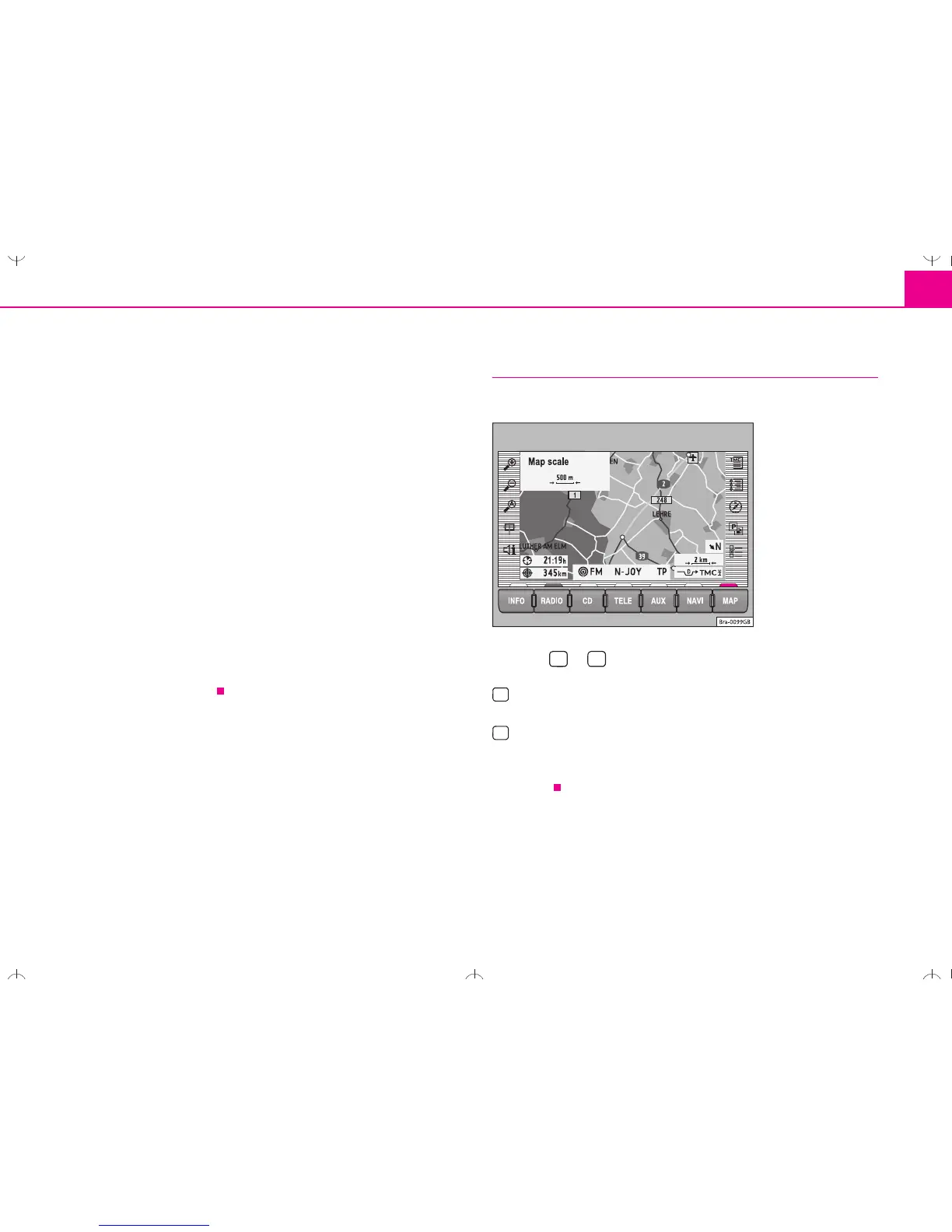
Changing the scale
You can choose from a total of 13 different scales.
– Press or .
– More details. A scale display appears in the top left-hand corner
when the button is pressed ⇒ fig. 39
– Large overview. A scale display appears in the top left-hand corner
when the button is pressed.
The selected scale will be shown once the menu knob is pressed or after
3 seconds.
 Loading...