Navigation32
Map and symbol displays
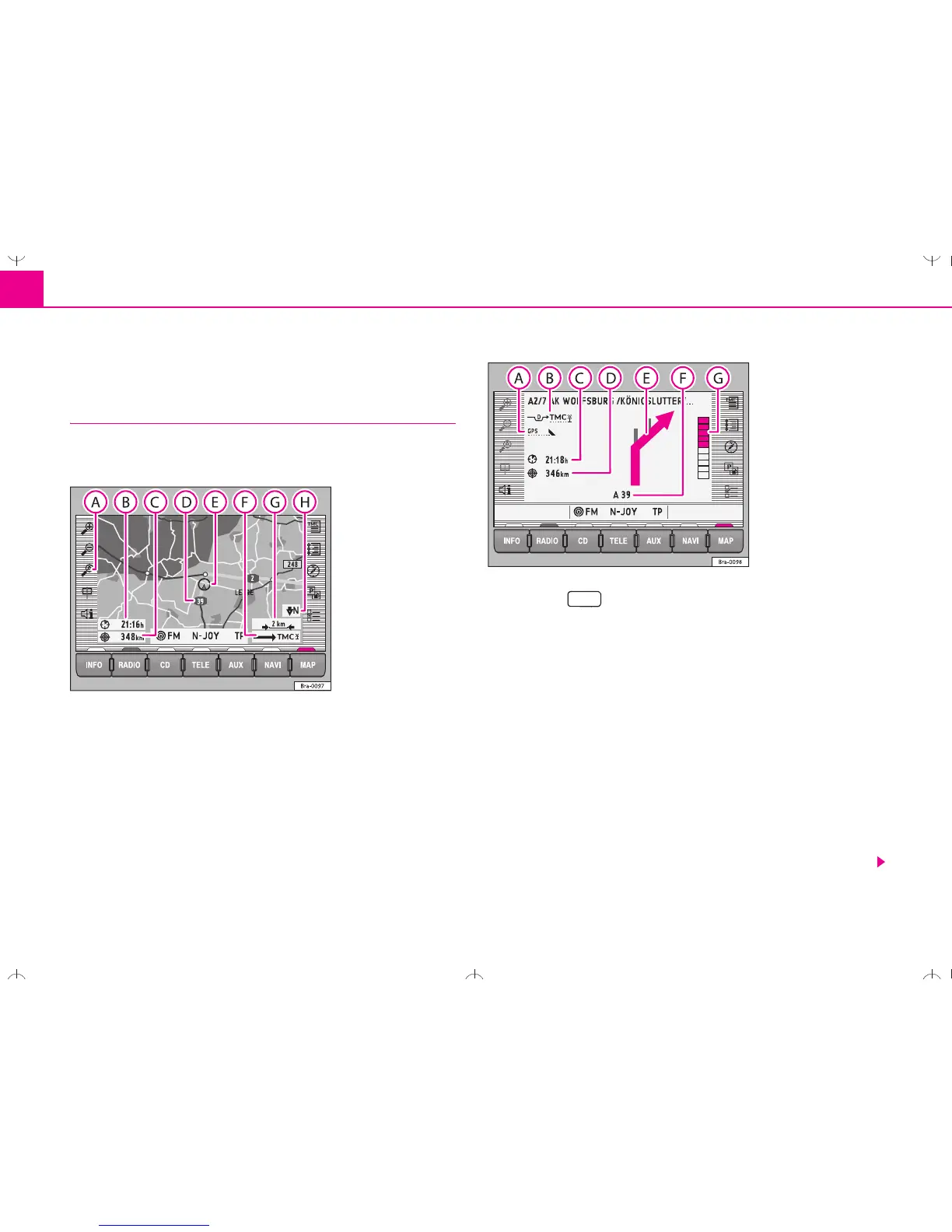
Information in the map and symbol displays
Information on the route will be shown in the map or
symbol displays if the route guidance function is active.
– Press the button ⇒ page 2, fig. 1 . The screen will
switch between map and symbol displays.
Map display
Autozoom active ( in orange). The scale of the map will, for
example, be larger for motorway driving and more detailed when
making a turn.
Journey time or arrival time
Distance to destination or stopover
Road name
Vehicle position - The black arrow points in the direction of travel. The
route ahead is shown as a blue line.
Route options and TMC:
− If the dynamic route guidance option is active, the horizontal arrow
is shown with a D, and blocked roads are shown as .
Fig. 37 Map display
Fig. 38 Symbol display
MAP
 Loading...