Do you have a question about the Sokkia iM-55 and is the answer not in the manual?
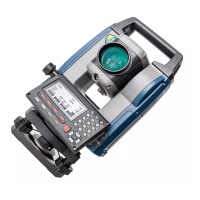
| Brand | Sokkia |
|---|---|
| Model | iM-55 |
| Category | Measuring Instruments |
| Language | English |
Details safety precautions for handling batteries and chargers to prevent hazards.
Lists general warnings and cautions to prevent injury or property damage.
Outlines safety precautions for setting up and using the instrument with a tripod.
Lists critical warnings and safety instructions for laser beam usage to prevent injury.
Provides cautions regarding laser beam handling and operation to prevent potential harm.
Explains fundamental key presses, navigation, and input methods.
Explains the various screen displays and their components.
Provides step-by-step instructions and precautions for charging the instrument's battery.
Details the procedure for correctly installing and removing the battery from the instrument.
Explains how to position the instrument precisely over the survey point.
Describes the process of leveling the instrument using leveling foot screws.
Details the steps for turning the instrument on, including password entry.
Explains the procedure for safely turning off the instrument and the function of the reset button.
Guides users on setting up and establishing Bluetooth communication.
Provides instructions on how to accurately sight a target using the instrument.
Explains how to measure the angle between two points using the 0SET function.
Details how to set a specific horizontal angle or hold the current angle.
Guides on checking the reflected signal strength for accurate distance measurements.
Explains how to measure distance and angle simultaneously.
Explains measuring coordinates and outputting them to external devices.
Describes the Remote Height Measurement (REM) function.
Details inputting station coordinates, height, and backsight information.
Explains determining station coordinates via resection measurement.
Explains the process for measuring 3D coordinates of a target point.
Details how to set out points based on input coordinates.
Explains setting out points based on horizontal angle and distance.
Describes how to perform Remote Height Measurement (REM) for setting out points.
Details the procedure for defining a baseline used in setting-out line measurements.
Explains how to find required point coordinates by inputting length and offset.
Describes measuring points relative to a baseline.
Details how to define an arc by inputting parameters or observing points.
Explains how to find coordinates of points along an arc.
Describes how to define a baseline for projecting points.
Explains how to measure and define target point coordinates relative to a baseline.
Covers the initial setup and configuration for topography observation.
Details measuring distances between multiple points, including missing line calculations.
Explains how to measure and define target point coordinates relative to a baseline.
Covers registering and deleting known point coordinate data.
Guides on transferring JOB data to a host computer.
Details the procedure for physically inserting a USB flash drive.
Explains the correct procedure for removing a USB flash drive.
Details the process of saving JOB data to a USB flash drive.
Guides on loading data from USB to the instrument.
Guides on allocating, registering, and recalling softkey functions.
Details the procedure for checking and adjusting the instrument's circular level.
Explains how to check and cancel tilt zero point errors.
Describes measuring and correcting collimation errors.
Details specifications for angle measurement capabilities.
Lists specifications for distance measurement.
Details the accuracy specifications for distance and angle measurements.