Sharing routes
Installing Tyre Pro
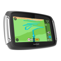
You can use Tyre Pro® to search, create and edit routes on your computer before you upload them
to your TomTom Rider.
To get free access to Tyre Pro®, follow the steps below:
1. Go to tomtom.com/getstarted and select your country.
2. Connect your Rider to your computer to link your device to your account and register with us.
3. Within 24 hours you will receive an email with a unique Tyre code and URL. Use this code and
URL to activate and download your Tyre Pro® software.
About routes and tracks
The term "route" includes two types of path from one place to another:
Routes have a beginning and an end and optionally some stops in between. Your device
calculates your preferred type of path between all these points, for example, the fastest or
most economical. You can edit a route by, for example, adding stops or moving the starting
point. Routes can be imported but cannot be exported from your device.
Tracks also have a beginning and an end but no stops. Your device however has a fixed
map-dependent path between these points and your device sticks to this fixed path as much as
possible. You can only edit tracks using tools such as Tyre Pro. Tracks can be imported and
exported from your device.
Tip: Tracks have a dotted arrow!
About GPX and ITN files
GPX files (gps exchange format)
GPX files contain a very detailed recording of where you have been on your track, including any
off-road locations. GPX files become tracks after import.
Using GPX files
There are several things you can do with your GPX file:
Use a tool such as Tyre Pro to view your track file.
Export to a memory card or directly to your computer, then use your computer to view the file
using software such as Google Earth.
Note: While viewing your recording, you may notice that the recorded GPS locations do not
always correspond with the roads. This can happen for several reasons. Firstly, your device
tries to keep the files small and this can cause a slight loss of data precision. Secondly, your
device records the actual data from the GPS chip for an accurate representation of where
you’ve been, rather than what you see on your screen. Thirdly, the software with which you
view the recording may have the maps misaligned.
 Loading...