Do you have a question about the Volvo RTI and is the answer not in the manual?
Initial steps and basic operations for the navigation system.
Explains how to use the manual and provides general system overview.
Details system startup, settings, and operation via various controls.
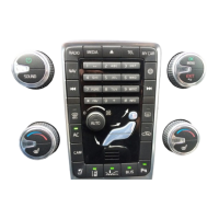
Visual overview of navigation system components like antenna, main unit, screen, and controls.
Methods for entering data using keypads, voice commands, and screen interface.
Covers DVD disc handling, screen care, map display, and menu navigation.
How to enter addresses, cities, and street details for destination programming.
Search for and select Points of Interest (POI) as destinations.
Methods for searching by location and managing saved locations.
Creating, editing, and managing itineraries with multiple stops.
Configuring route type, proposals, traffic info, and voice guidance settings.
How to run a simulated demonstration of the navigation journey.
Overview of traffic information display, reception, and presentation.
How to read detailed traffic information and understand map symbols.
Identifying traffic issues and calculating alternative routes to bypass them.
How to select and display Points of Interest (POI) on the map.
A comprehensive list of symbols for various facilities shown on the map.
Answers to common questions about system accuracy, behavior, and map data.
The end-user license agreement for the navigation database.
An alphabetical listing of topics and their corresponding page numbers.
| Category | Car Navigation system |
|---|---|
| Manufacturer | Volvo |
| Name | RTI |
| Display Type | LCD |
| Auxiliary Input | Yes |
| 3D Maps | Yes |
| Points of Interest | Yes |
| Touchscreen | Yes |
| Traffic Information | Yes |
| Navigation System | Yes |
| Voice Control | Yes |
| Bluetooth | Yes |
| USB Port | Yes |
| Real-Time Traffic Updates | Yes |
| Map Updates | Yes |
| Display Size | 7 inches |