EasyManuals Logo

Apollo MX20 User Manual

Default Icon
35 pages
To Next Page IconTo Next Page
To Previous Page IconTo Previous Page
Page #14 background imageLoading...
Page #14 background image
Dctailcd
Opcration
Messa
Lo
Function
inese I
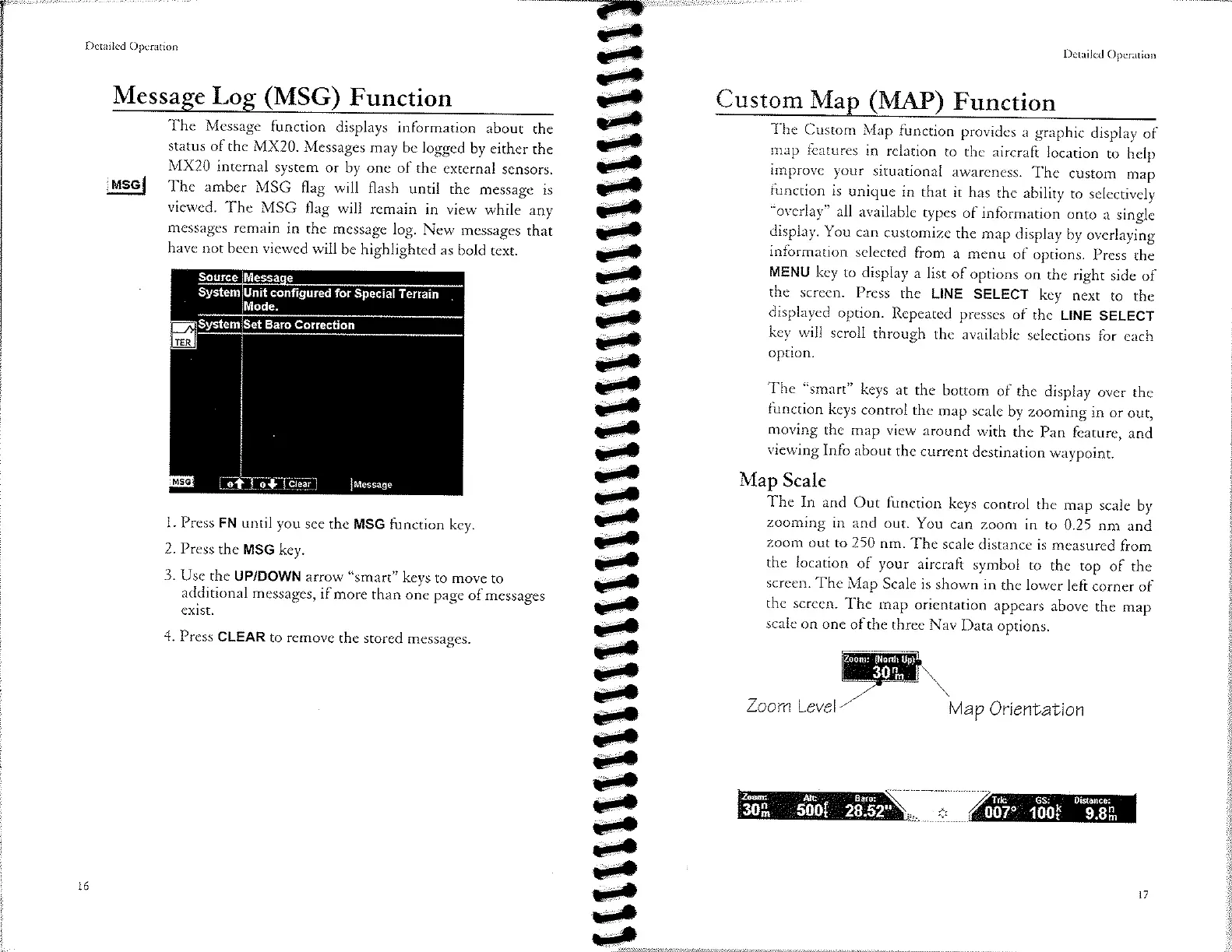
The
Message
function
displays
information
about
the
status
of
the
MX20.
Messages
may
be logged
by either
the
MX20
internal
sysrem
or
by one
of the
external
sensors.
The
amber
MSG flag will
flash
until
the
message
is
viewed.
The
MSG
flag will
remain
in view
while
any
messages
remain
in the
message
log.
New
messages
that
have
not
been viewed
will
be
highlighted
as
bold
text.
1. Press FN
until you
see
the MSG
function
key.
2.
Press
the MSG
key.
3.
Use
the UP/DOWN
arrow
"smart"
keys
to
move
to
additional
messages,
if
more than
one
page
of messages
exlst.
4.
Press
CLEAR
to remove
the
stored
messages.
c-
J-
e-
J-
3-
É
É
ù-
ú-
3)
t-
ù-
J)
a¡-
c)
¿)
J)
i)
t-
J-
J)
r-
J)
J-
J-
¡-
t-
¡-
¡-
È-
G)
r-
c-
Èa
é
é
l6
-----?F
c-
c-
J'
e-
Dctailcd
Opcration
Custom
Ma
(ruAP
Function
The
Custom
Map
function
provides
a
graphic
display
of
map
features
in
relation
to the
aircraft
location
ro help
improve
your
situational
awareness.
The
custom
map
function
is unique
in
that it
has
the
ability
to
selectively
"overlay"
all
available
types
of information
onto
a
single
display.
You
can
customize
the
map
display
by
overlaying
information
selected
from
a menu
of options.
press
the
MENU
key
to
display
a list
of
options
on rhe
right
side
of
the
screen.
Press
the LINE
SELECT
key
nexr
to rhe
displayed
oprion.
Rcpeated
presses
of
the LINE
SELECT
key will
scroll
through
the
available
selections
for
each
option.
The
"smarr"
keys
at
the
bottom
of the
display
over
the
function
keys
control
the
map
scalc
by
zooming
in or
out,
moving
the
map view
around
with
the
pan
feature,
and
viewing
Info
about
rhe
currenr
destination
waypoint.
Map
Scale
The
In
and Out
function
keys
control
the
map
scale
by
zooming
in
and
out.
You
can
zoom
in
to 0.25
nm
and
zoom
out to
250
nm.
The
scale
distance
is
measured
from
the
location
of your
aircraft
symbol
ro rhe
top
of
the
screen.
The
Map
Scale
is
shown
in
the lower
left
corner
of
the screen.
The
map
oricntation
appears
above
the
map
scale
on
one
of the
three
Nav
Data
options.
F.
Zoom
Level/
Map
Oríentation
System
Unit
configured
for
Special
Terrain
System
Set
Baro
Correct¡on
o1 ol
lcrearl
luessage
007"
100r
9.sp,

Other manuals for Apollo MX20

Questions and Answers:

Question and Answer IconNeed help?

Do you have a question about the Apollo MX20 and is the answer not in the manual?

Apollo MX20 Specifications

General IconGeneral
BrandApollo
ModelMX20
CategoryMonitor
LanguageEnglish