EasyManuals Logo

Apollo MX20 User Manual

Default Icon
35 pages
To Next Page IconTo Next Page
To Previous Page IconTo Previous Page
Page #22 background imageLoading...
Page #22 background image
Dctailcd Opcration
Traf;fic
Function
-æ--
G-
eaa
ê
ÇÐ
ã
ê
a
J-
caa
J-
e-
t-
e-
C-
ê
ê
ê
ê
ê
ê
e-
ea
Dctailcd
Opcration
360
sets the current track
of the aircraft
at the top
of the
screen and
a 360" ring with
the aircraft
symbol position
in
the center. Desired
Track
Up sets the desired
track
to the
next
waypoint
as the top of
the screen.
Press the LINE
SELECT
key next to
this oprion to
scroll
through the
options.
fnvert
The
Invert
option changes the
text and
background
color.
Inverting
the display may
help readability
for
the current
lighting conditions
and the
color of the
terrain in
a given
area.
Nav Data
The
Nav Data option
allows
to control
the display
of
navigation
data
on the Map
displays.
Subsequent presses
of the LINE SELECT
key
for this option provides
choices
of
no nav
data, nav
data in the corners
(waypoint,
bearing,
zoom) and
distance),
or full nav
data. The full
nav
data
option includes
the information
in the
four corners
selection
plus
altitude,
barometer
setting, tracþ
and
ground
speed.
Label
The
LABEL key
turns
the labels
over each item
of
information
on
or off
When
Labels
are turned
ofÇ
only
the
identifier for waypoints
along the
flight
plan
will
remain in view
when
the flight plan
is enabled.
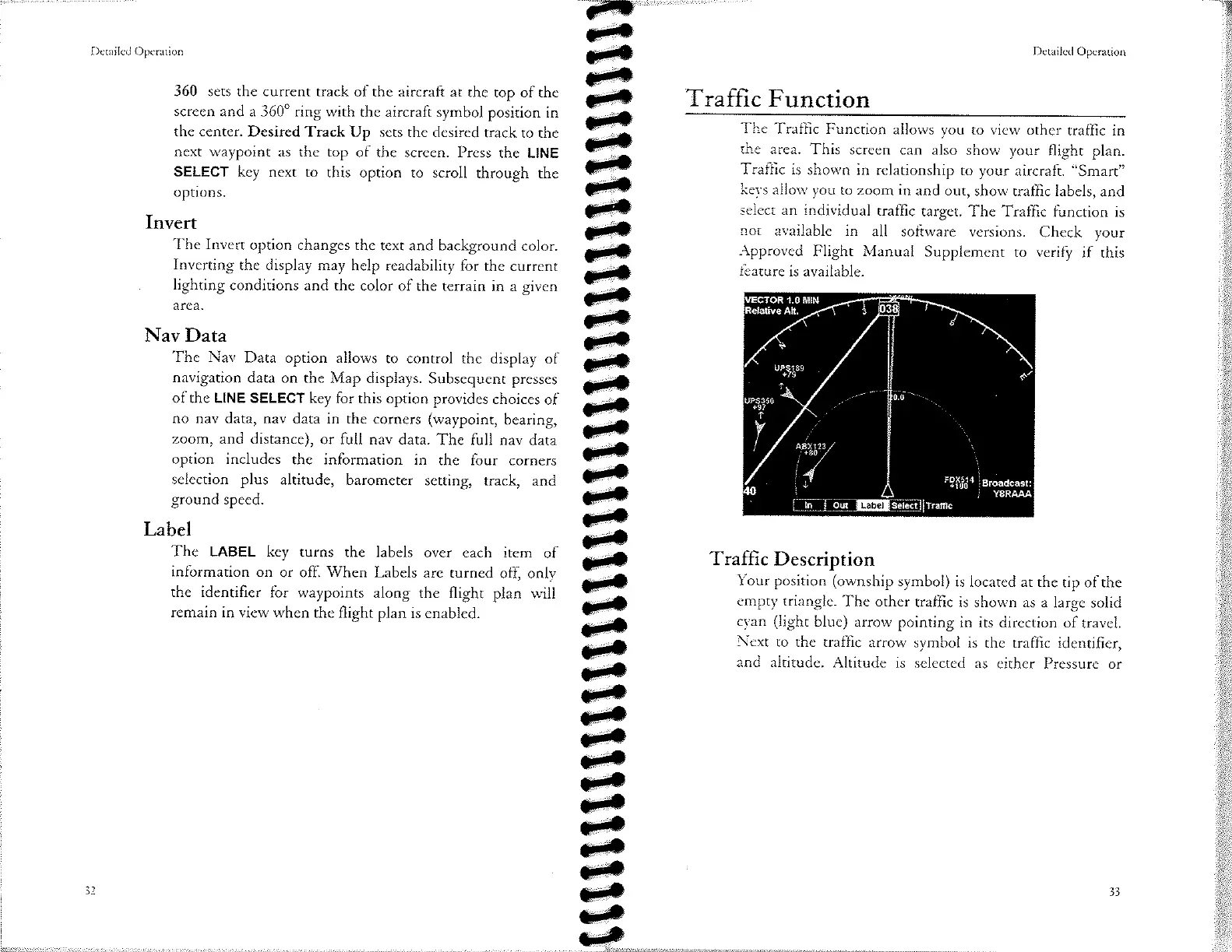
The
Traffic
Function
allows you
ro view
other
traffic in
the
area.
This
screen can
also show your
flight plan.
Traffic
is
shown in relationship
to
your
aircraft.
"Smart"
kevs
allow you
to zoom
in and
out, show
traffic labels, and
select an individual
traffic
target.
The Traffic
function
is
not
available
in all
software versions.
Check
your
Äpproved
Flight
Manual
Supplement
to veri$
if this
feature
is available.
Traffìc
Description
Your position
(ownship
symbol)
is located at
the tip of
the
empty
triangle.
The other
traffic is shown
as a large
solid
cyan
(light
blue) arrow
pointing
in its
direction of travel.
Next
to the traffic
arrow symbol
is
the traffic identifier,
and altitude.
Altitude
is selected
as either
Pressure or
I t.
,¿
I
I
33

Other manuals for Apollo MX20

Questions and Answers:

Question and Answer IconNeed help?

Do you have a question about the Apollo MX20 and is the answer not in the manual?

Apollo MX20 Specifications

General IconGeneral
BrandApollo
ModelMX20
CategoryMonitor
LanguageEnglish