EasyManuals Logo

Apollo MX20 User Manual

Default Icon
35 pages
To Next Page IconTo Next Page
To Previous Page IconTo Previous Page
Page #16 background imageLoading...
Page #16 background image
'4
c-
e-
ê
J-
e)
J-
e)
J'-
J-
J-
J-
J)
J-
e-
J-
J-
J)
J-
e)
e)
a)
.-
e'-
o-
J)
o-
J)
J-
C-
J-
e)
J)
e)
J-
J)
J-
J-
e-
arr^
a;a
é
20
,
Dctailcd
Opcration
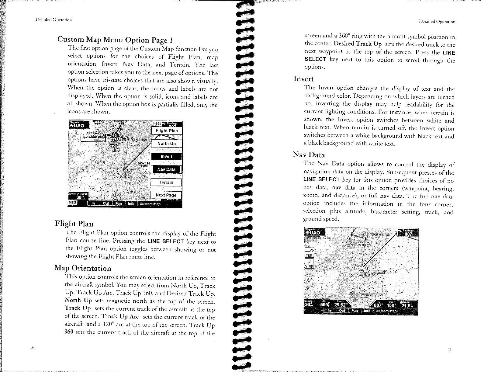
Custom
Map
Menu
Option
Page
I
The
first
option
page
of the
Cusrom
Map
function
lers
you
select
options
for
the
choices
of Flighr
plan,
map
orientation,
Invert,
Nav
Data,
and
Terrain.
The
lasr
option
selection
takes
you
to rhe
nexr
page
of
options.
The
options
have
tri-state
choices
rhat
are
also
shown
visually.
When
the
option
is
clear,
the
icons
and
labels
are
nor
displayed.
When
the option
is
solid,
icons
and
labels
are
all
shown. When
the option
box
is partially
filled,
only
the
icons
are
shown.
Flight
Plan
The
Flight
Plan
option
conrrols
the
display
of
the Flight
Plan
course
line.
Pressing
thc
LINE
SELECT
key
next
to
the
Flight
Plan
option
togglcs
between
showing
or
nor
showing
the
Flight
Plan
route
line.
Map
Orientation
This
option
controls
rhe
screen
oricntation
in
reference
to
thc aircraft
symbol.
You
may
sclect
from
North
Up,
Track
Up,
Track
Up Arc,
Track
Up
360, and
Desired
Track
Up.
North
Up
sets
magnetic
north
as thc
top
of
the screen.
Track
Up
sets
the
current
track
of
the aircraft
as the
top
of
the
screen.
Track
Up
Arc
sets
rhe
currenr
track
of rhe
aircraft
and
a l20o
arc
ar the
top
of
thc
screen.
Track
Up
360
scts
the
currenr
track
of the aircrafr
at
the
top
of the
l)crrilccl
Opcration
scrccn
and
a 360"
ring with
the
aircraft
symbol
position
in
the
ccnrcr.
Desired
Track
Up
sets
thc
dcsircd
track
to
thc
next
waypoint
as
thc
top
of
thc scrccn.
prcss
thc
LINE
SELECT
kcy next
to
this
oprion
to
scroll
through
thc
options.
Invert
The
Invert
option
changes
the
display
of
tcxt and
thc
background
color.
Depending
on which
layers
are turned
on,
inverring
the
display
may
help
readability
for
thc
current
lighting
conditions.
For
instancc,
when
tcrrain
is
shown,
the
Invcrt
option
switchcs
between
white
and
black
text. Whcn
terrain
is
turned
ofl
the
Invert
option
switchcs
bctween
a
white
background
with
black
rexr
and
a
black
background
with
white
text.
Nav
Data
The
Nav
Data
option
allows
to conrrol
thc
display
of
navigation
dara
on
thc
display.
Subscqucnt
presses
of
the
LINE
SELECT
key for
this
option
providcs
choiccs
of no
nav
data,
nav
data
in
thc
corners
(waypoint,
bearing,
zoom,
and
distance),
or
full
nav
dara.
Thc
full
nav
data
option
includes
the
information
in
the four
corners
selection
plus
altitudc,
barometer
setting,
track,
and
ground
speed.

Other manuals for Apollo MX20

Questions and Answers:

Question and Answer IconNeed help?

Do you have a question about the Apollo MX20 and is the answer not in the manual?

Apollo MX20 Specifications

General IconGeneral
BrandApollo
ModelMX20
CategoryMonitor
LanguageEnglish