BT2 user manual - H-5911-9004-02-B Page | 8
deployment, this link will usually be disconnected. Therefore, before deployment, the date and time in the probe are
synchronised with the date and time in the tablet. From this point, the probe starts recording IMU data into its internal
memory. Readings are taken every second and the probe’s LEDs visually indicate that this process is ongoing.
Each sensor record in the probe is accompanied by a time stamp.
At each deployment interval, with the system held steady, the operator on the surface records a time stamp using
Carlson Boretrak.
Once a survey has been completed, and the Boretrak2 is back on the surface, the Bluetooth link is re-established
and all IMU data from the probe is automatically downloaded to Carlson Boretrak.
Carlson Boretrak reads the time stamps recorded on the tablet and extracts the records in the probe data which
have matching time stamps.
With reference to a starting hole collar coordinate and an initial alignment heading, these raw observations are
converted into a sequence of X, Y, Z coordinates. A model of the hole is then created, and a comparison can be
made to a design hole or another survey of the same hole.
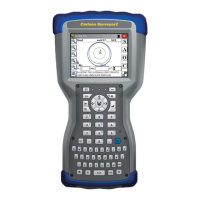
2.4 Carlson Boretrak software
Carlson Boretrak software acts as the survey controller which enables you to set up projects, manage holes,
conduct the survey, and view results.
Versions of Carlson Boretrak are available to run on a Windows tablet or an Android mobile device.
Carlson Boretrak displays real-time data from the probe while the Bluetooth connection is live. During a
deployment, the probe is in a borehole, so the connection is usually disconnected. The connection is automatically
re-established when a hole survey is complete, and the probe has been retrieved to within Bluetooth range of the
tablet.
After downloading data, a visual inspection of the hole survey is possible. You can compare the surveyed hole with
design data and export the project for use in other software packages from Carlson or in third party packages.
Carlson Boretrak allows you to manage the geo-referencing of the holes, and to send final data directly from the
field.
Back in the office Carlson Boretrak can run in Desktop mode on an office PC. This allows a more comprehensive
data analysis to be conducted, and reports and exports can be generated.